|
search place name
|
||
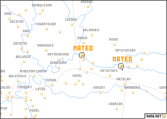
Mateo (North Cotabato, Philippines)Mateo is a town in the North Cotabato region of Philippines. An overview map of the region around Mateo is displayed below.
regional and 3d topo map of Mateo, Philippines ::
Mateo airports ::
The nearest airport is CEB - Cebu Cotabato, located 67.1 km west of Mateo.
Other airports nearby include CGY - Ladag Cagayan De Oro (143.6 km north), LGP - Legazpi Pagadian (168.4 km north west), Nearby towns ::
Tacolen (0.0km north) //
Lamayong (0.0km north) //
Kibudtungan (0.0km north) //
Kilabeg (0.0km north) //
Bangilan (0.0km north) //
Bual (0.0km north) //
Banawa (0.0km north) //
Simone (0.0km north) //
Malapag (0.0km north) //
Masalinan (0.0km north) //
Liliten (1.9km north) //
Kinudal (1.9km north) //
Badebe (1.9km north) //
Balatongkayo (1.9km north) //
Tumangon (1.9km north) //
Dimagus (1.9km north) //
Tual (1.9km north) //
Timbangan (1.9km north) //
Tatas (1.9km north) //
Ilian (1.9km north) //
Kilada (1.9km north) //
Nasalinan (1.9km north) //
Limbalod (1.9km north) //
Salapuñgan (1.9km north) //
Pidtulusan (1.9km north) //
Padtad (1.9km north) //
Saupen (1.9km north) //
Sampen (1.9km north) //
Pagagawan (1.9km north) //
[all distances 'as the bird flies' and approximate] 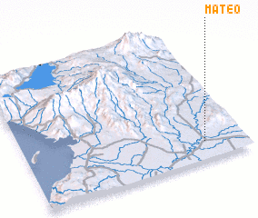 Places with similar names to Mateo, Philippines ::
Disclaimer :: Information on this page comes without warranty of any kind |
||
|
Where is Mateo? Elevation and coordinates ::
Latitude (lat): 7°8'0"N Longitude (lon): 124°49'0"E
Elevation (approx.): 23m (map arrows pan, magnifying glasses zoom) |
||
|
Visiting Mateo? Hotel/Accommodation ::
Book a hotel in Mateo Travel Guide ::
Buy a travel guide for Philippines rental cars ::
car rental offers GPS waypoint ::
download a GPX waypoint (PoI) of Mateo for your GPS receiver
|
||