|
search place name
|
||
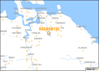
Nagbobtac (Northern Samar, Philippines)Nagbobtac is a town in the Northern Samar region of Philippines. An overview map of the region around Nagbobtac is displayed below.
regional and 3d topo map of Nagbobtac, Philippines ::
Nagbobtac airports ::
The nearest airport is TAC - Tacloban Daniel Z Romualdez, located 141.2 km south of Nagbobtac.
Nearby towns ::
Hangtud (2.1km north west) //
Capacuhan (3.0km north east) //
Bañgon de Cacorotan (3.2km east) //
Napo (3.6km north) //
Matambag (3.6km north) //
Cabariuan (3.6km north) //
San Antonio (3.6km north) //
Canomanio (3.6km north) //
Pio del Pilar (3.6km north) //
Mombon (3.6km north) //
Hibatuan (4.2km east) //
Cagjoguinog (4.2km east) //
Osmeña (4.6km east) //
Rombang (4.6km south west) //
Natauo (4.7km north west) //
Tinublan (4.8km west) //
Libas (4.8km west) //
Palapag (5.1km north) //
Simora (5.3km south west) //
Lagadean (5.5km north east) //
Sañgay (5.9km north east) //
Yapas (6.2km south west) //
Manahao (6.2km north west) //
Bauang (6.9km west) //
Vigo (7.1km west) //
Talolora (7.3km north) //
Monbon (7.4km north) //
Boris (7.5km north west) //
La Perla (7.7km south west) //
[all distances 'as the bird flies' and approximate] 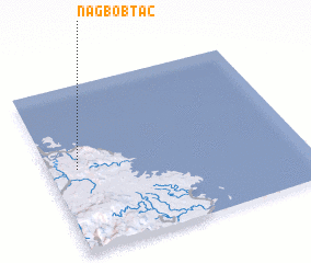 Places with similar names to Nagbobtac, Philippines :: Disclaimer :: Information on this page comes without warranty of any kind |
||
|
Where is Nagbobtac? Elevation and coordinates ::
Latitude (lat): 12°30'4"N Longitude (lon): 125°6'40"E
Elevation (approx.): 38m (map arrows pan, magnifying glasses zoom) |
||
|
Visiting Nagbobtac? Hotel/Accommodation ::
Book a hotel in Nagbobtac Travel Guide ::
Buy a travel guide for Philippines rental cars ::
car rental offers GPS waypoint ::
download a GPX waypoint (PoI) of Nagbobtac for your GPS receiver
|
||