|
search place name
|
||
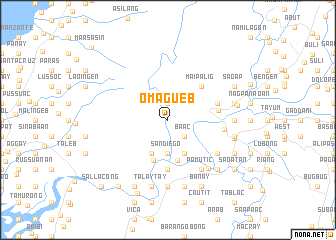
Omagueb (Abra, Philippines)Omagueb is a town in the Abra region of Philippines. An overview map of the region around Omagueb is displayed below.
regional and 3d topo map of Omagueb, Philippines ::
Omagueb airports ::
The nearest airport is BAG - Baguio, located 137.6 km south of Omagueb.
Nearby towns ::
Dagat (1.9km north) //
Baac (2.6km south east) //
Cauggan (3.7km south) //
San Diego (3.7km south) //
Langiden (4.1km south east) //
Quillat (4.1km south east) //
Caloag (4.1km south west) //
Dalayap (4.7km south) //
Mabongtot (4.8km south) //
Maipalig (5.1km north east) //
Sideg (5.6km south) //
San Antonio (5.5km east) //
Bañacao (5.6km east) //
Patucannay (6.1km east) //
Mingang (6.6km south east) //
Pamutic (6.6km south east) //
Nagtalobungan (6.5km south east) //
Pidigan (6.9km south east) //
Garreta (7.4km south) //
Calaba (7.1km east) //
Pantay Baggoc (7.4km south) //
Fomodoc (7.3km east) //
Cabuloan (7.3km east) //
Quilliat (7.3km east) //
Talaytay (7.6km south) //
Caburao (7.6km south) //
Suyo (7.6km south) //
Bangued (7.3km east) //
Induyong (7.7km south east) //
[all distances 'as the bird flies' and approximate] 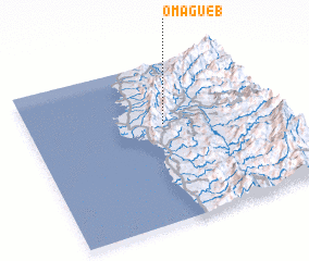 Places with similar names to Omagueb, Philippines ::
// Om Mok (1) (LA)
Disclaimer :: Information on this page comes without warranty of any kind |
||
|
Where is Omagueb? Elevation and coordinates ::
Latitude (lat): 17°37'0"N Longitude (lon): 120°33'0"E
Elevation (approx.): 47m (map arrows pan, magnifying glasses zoom) |
||
|
Visiting Omagueb? Hotel/Accommodation ::
Book a hotel in Omagueb Travel Guide ::
Buy a travel guide for Philippines rental cars ::
car rental offers GPS waypoint ::
download a GPX waypoint (PoI) of Omagueb for your GPS receiver
|
||