|
search place name
|
||
Pacuang (Camarines Norte, Philippines)Pacuang is a town in the Camarines Norte region of Philippines. An overview map of the region around Pacuang is displayed below.
regional and 3d topo map of Pacuang, Philippines ::

Pacuang airports ::
The nearest airport is MNL - Manila Ninoy Aquino Intl, located 188.7 km west of Pacuang.
Nearby towns ::
Lubas (1.8km west) //
Gahagahagan (1.8km east) //
Malangcaobasud (2.0km north east) //
Calabasa (2.3km south) //
Daguit (2.9km north) //
Cabilagalin (3.6km west) //
Macababalo (3.6km west) //
Mabilo (3.6km west) //
Casipitan (3.6km east) //
Pinagtambangan (4.0km north east) //
Matanlang (4.3km south east) //
Idioc (5.4km east) //
Pangpang (5.4km east) //
Pagsanhan (5.7km east) //
Matagdan (5.7km east) //
Abuyog (5.8km west) //
Talobatib (6.4km east) //
Masolong (6.6km south east) //
Dagang (7.2km north east) //
Pilapilanay (7.2km west) //
Duancalao (7.2km west) //
Masalong (7.2km east) //
Bonijiagon (7.2km east) //
Tagbao (7.2km east) //
Baay (7.4km south) //
Malacabang (7.3km north east) //
Tinampo (7.6km north) //
Batobalane (7.6km north) //
Estanza (8.2km north west) //
[all distances 'as the bird flies' and approximate] 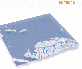 Places with similar names to Pacuang, Philippines ::
Disclaimer :: Information on this page comes without warranty of any kind |
||
|
Where is Pacuang? Elevation and coordinates ::
Latitude (lat): 14°10'0"N Longitude (lon): 122°44'0"E
Elevation (approx.): 46m (map arrows pan, magnifying glasses zoom) |
||
|
Visiting Pacuang? Hotel/Accommodation ::
Book a hotel in Pacuang Travel Guide ::
Buy a travel guide for Philippines rental cars ::
car rental offers GPS waypoint ::
download a GPX waypoint (PoI) of Pacuang for your GPS receiver
|
||