|
search place name
|
||
Pagnitoan (Bohol, Philippines)Pagnitoan is a town in the Bohol region of Philippines. An overview map of the region around Pagnitoan is displayed below.
regional and 3d topo map of Pagnitoan, Philippines ::

Pagnitoan airports ::
The nearest airport is NOP - Masbate Mactan Cebu Intl, located 62.2 km north of Pagnitoan.
Other airports nearby include DGT - Dumaguete (76.6 km south west), BCD - Bacolod (140.4 km north west), CGY - Ladag Cagayan De Oro (170.6 km south east), ILO - Iloilo (177.7 km north west), Nearby towns ::
Jandig (0.8km south east) //
Maribojoc (1.5km south west) //
Bayacabac (1.7km south) //
Dipatlong (2.0km west) //
Aliguay (2.1km south east) //
Agahay (2.9km south) //
Bood (3.1km south west) //
Aghao (3.2km east) //
Tiwi (3.2km north west) //
Bugjo (3.3km north east) //
Lincod (3.3km south east) //
Tinawan (3.7km north) //
Cabawan (3.8km east) //
Candavid (3.8km east) //
Canoc-oc (3.8km north east) //
Cabadog (3.8km west) //
Lagtangon (3.9km south west) //
Cabug (4.0km west) //
Busao (4.3km south east) //
Canmanok (4.4km north west) //
Nagtuang (4.5km north) //
Tubodio (5.0km north west) //
Agsoso (5.2km north west) //
Cortes (5.2km south east) //
Bongahan (5.5km east) //
Ticogan (5.5km north west) //
Tagobaas (5.7km north east) //
Antequera (5.8km north east) //
Badbad (5.8km north west) //
[all distances 'as the bird flies' and approximate] 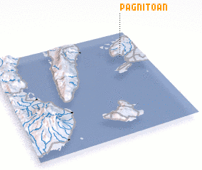 Places with similar names to Pagnitoan, Philippines ::
Disclaimer :: Information on this page comes without warranty of any kind |
||
|
Where is Pagnitoan? Elevation and coordinates ::
Latitude (lat): 9°45'35"N Longitude (lon): 123°51'2"E
Elevation (approx.): 69m (map arrows pan, magnifying glasses zoom) |
||
|
Visiting Pagnitoan? Hotel/Accommodation ::
Book a hotel in Pagnitoan Travel Guide ::
Buy a travel guide for Philippines rental cars ::
car rental offers GPS waypoint ::
download a GPX waypoint (PoI) of Pagnitoan for your GPS receiver
|
||