|
search place name
|
||
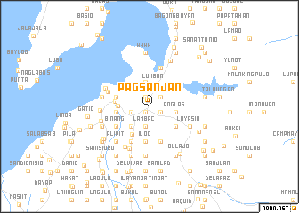
Pagsanjan (Laguna, Philippines)Pagsanjan is a town in the Laguna region of Philippines. An overview map of the region around Pagsanjan is displayed below.
regional and 3d topo map of Pagsanjan, Philippines ::
Pagsanjan airports ::
The nearest airport is MNL - Manila Ninoy Aquino Intl, located 53.6 km north west of Pagsanjan.
Nearby towns ::
Dingin (0.8km south west) //
Sampalucan (0.8km south west) //
Pinagsanghan (0.8km south west) //
Magdapio (0.8km south west) //
Maulawin (0.8km south west) //
Calasuche (1.3km north) //
Duhatan (1.5km south east) //
Maytalang (1.8km north east) //
Sabang (2.3km west) //
Maulawin (2.3km west) //
Lambac (2.6km south) //
Lumban (2.9km north) //
Balubad (3.1km north) //
Concepcion-Ibayo (3.1km north) //
Maytalang Number 2 (3.1km north) //
Lewin (3.1km north) //
Anglas (3.2km east) //
Moosegy (3.4km south west) //
Patimbao (3.9km west) //
Duhat (4.0km south east) //
Cabanbanan (4.1km south west) //
Palasan (4.1km west) //
Pagsawitan (4.1km west) //
San Pablo Sur (4.2km west) //
Jasaan (4.2km west) //
Calios (4.2km west) //
Labuin (4.2km west) //
Santisima Cruz Sur (4.2km west) //
San Pedro (4.2km west) //
[all distances 'as the bird flies' and approximate] 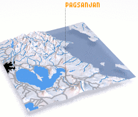 Places with similar names to Pagsanjan, Philippines :: Disclaimer :: Information on this page comes without warranty of any kind |
||
|
Where is Pagsanjan? Elevation and coordinates ::
Latitude (lat): 14°16'22"N Longitude (lon): 121°27'15"E
Elevation (approx.): 12m (map arrows pan, magnifying glasses zoom) |
||
|
Visiting Pagsanjan? Hotel/Accommodation ::
Book a hotel in Pagsanjan Travel Guide ::
Buy a travel guide for Philippines rental cars ::
car rental offers GPS waypoint ::
download a GPX waypoint (PoI) of Pagsanjan for your GPS receiver
|
||