|
search place name
|
||
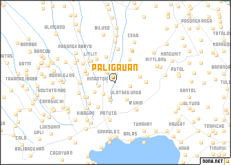
Paligauan (Cavite, Philippines)Paligauan is a town in the Cavite region of Philippines. An overview map of the region around Paligauan is displayed below.
regional and 3d topo map of Paligauan, Philippines ::
Paligauan airports ::
The nearest airport is MNL - Manila Ninoy Aquino Intl, located 37.7 km north of Paligauan.
Nearby towns ::
Baliti Segundo (1.6km north) //
Lalaan Primero (2.1km north west) //
Ulat Primero (2.4km east) //
Malabay (2.5km south) //
Lalaan Segundo (2.6km south west) //
Minantok (2.7km west) //
Malabag (3.0km south) //
Baliti Primero (3.2km north) //
Ulat Segundo (3.3km south east) //
Maymanga (3.7km south west) //
Lumil (4.0km east) //
Pook (4.4km north east) //
Luksuhin (4.5km north) //
Bucal (4.7km west) //
Maitim (4.8km south west) //
Calubcob (4.9km north west) //
Casile (4.9km east) //
Talon (5.1km south west) //
Dagatan (5.1km west) //
Litlit (5.2km north west) //
Ida (5.5km north) //
Maitim Segundo (5.4km south west) //
Loma (5.4km south west) //
Bababing (5.5km north west) //
Iruhin (5.5km south east) //
Amadeo (5.5km west) //
Carmen (5.7km north east) //
Mutingilog (5.8km north east) //
Patuto (6.1km south) //
[all distances 'as the bird flies' and approximate] 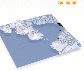 Places with similar names to Paligauan, Philippines ::
Disclaimer :: Information on this page comes without warranty of any kind |
||
|
Where is Paligauan? Elevation and coordinates ::
Latitude (lat): 14°10'16"N Longitude (lon): 120°58'30"E
Elevation (approx.): 429m (map arrows pan, magnifying glasses zoom) |
||
|
Visiting Paligauan? Hotel/Accommodation ::
Book a hotel in Paligauan Travel Guide ::
Buy a travel guide for Philippines rental cars ::
car rental offers GPS waypoint ::
download a GPX waypoint (PoI) of Paligauan for your GPS receiver
|
||