|
search place name
|
||
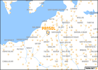
Pansol (Laguna, Philippines)Pansol is a town in the Laguna region of Philippines. An overview map of the region around Pansol is displayed below.
regional and 3d topo map of Pansol, Philippines ::
Pansol airports ::
The nearest airport is MNL - Manila Ninoy Aquino Intl, located 49.9 km north west of Pansol.
Nearby towns ::
San Antonio (0.7km west) //
Masico (1.5km south east) //
Concepcion (1.9km north) //
Bukal (1.9km north) //
Pila (2.0km north west) //
Danio (2.0km south) //
San Miguel (2.2km south east) //
Dagatan (2.2km south east) //
Mojon (2.7km east) //
San Isidro (2.9km east) //
Labuin (3.2km north) //
Bancabanca (3.1km south west) //
Oogong (3.4km north east) //
Bangcabangca (3.5km south) //
Malinao (3.5km south east) //
Buhanginan (3.5km south east) //
San Francisco (3.5km west) //
Wakat (3.8km south) //
Manaol (3.8km south) //
San Jose (3.8km north east) //
Calumpang (3.8km south east) //
Pinagbayanan (3.9km north west) //
Sibulan (3.9km south) //
Silañgan Cabubuhayan (3.9km south) //
Maravilla (3.9km south) //
Duhat (4.0km north) //
Masapang (4.0km south west) //
San Felix (4.3km west) //
Linga (4.4km north) //
[all distances 'as the bird flies' and approximate] 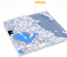 Places with similar names to Pansol, Philippines ::
Disclaimer :: Information on this page comes without warranty of any kind |
||
|
Where is Pansol? Elevation and coordinates ::
Latitude (lat): 14°13'2"N Longitude (lon): 121°22'23"E
Elevation (approx.): 22m (map arrows pan, magnifying glasses zoom) |
||
|
Visiting Pansol? Hotel/Accommodation ::
Book a hotel in Pansol Travel Guide ::
Buy a travel guide for Philippines rental cars ::
car rental offers GPS waypoint ::
download a GPX waypoint (PoI) of Pansol for your GPS receiver
|
||