|
search place name
|
||
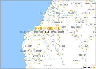
Pantar Norte (La Union, Philippines)Pantar Norte is a town in the La Union region of Philippines. An overview map of the region around Pantar Norte is displayed below.
regional and 3d topo map of Pantar Norte, Philippines ::
Pantar Norte airports ::
The nearest airport is BAG - Baguio, located 55.3 km south east of Pantar Norte.
Nearby towns ::
Baracbac Oeste (0.2km south east) //
Pantar Sur (1.6km west) //
Rissing (1.7km north) //
Bulbulala (2.0km south) //
Patpata (2.0km south) //
Sinapangan Sur (1.9km east) //
Baracbac Este (1.9km east) //
Balaoan (2.1km south west) //
Cantoria (2.4km north west) //
Calungbuyan (2.6km south west) //
San Pablo (2.6km south west) //
Bet-ang (2.6km south west) //
Tal-li-pugo (2.6km south west) //
Butubut Oeste (2.6km south west) //
Nalasin (2.6km south west) //
Napaset (2.6km south west) //
Pagleddegan (2.6km south west) //
Guinaburan (2.6km south west) //
Sablot (2.6km south west) //
Butubut Este (2.6km south west) //
Sinapangan Norte (2.6km north east) //
Oaqui (2.7km north) //
Dirdirig (2.8km south east) //
Tallaoen (3.4km west) //
Nagrebcan (3.4km west) //
Camiling (3.8km south) //
Masupe (3.8km south) //
San Francisco (3.7km east) //
Santo Domingo Sur (3.8km north west) //
[all distances 'as the bird flies' and approximate]  Places with similar names to Pantar Norte, Philippines :: Disclaimer :: Information on this page comes without warranty of any kind |
||
|
Where is Pantar Norte? Elevation and coordinates ::
Latitude (lat): 16°50'4"N Longitude (lon): 120°24'55"E
Elevation (approx.): 17m (map arrows pan, magnifying glasses zoom) |
||
|
Visiting Pantar Norte? Hotel/Accommodation ::
Book a hotel in Pantar Norte Travel Guide ::
Buy a travel guide for Philippines rental cars ::
car rental offers GPS waypoint ::
download a GPX waypoint (PoI) of Pantar Norte for your GPS receiver
|
||