|
search place name
|
||
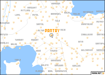
Pantay (Batangas, Philippines)Pantay is a town in the Batangas region of Philippines. An overview map of the region around Pantay is displayed below.
regional and 3d topo map of Pantay, Philippines ::
Pantay airports ::
The nearest airport is MNL - Manila Ninoy Aquino Intl, located 44.6 km north of Pantay.
Nearby towns ::
Santiago (1.3km east) //
Sala (2.0km south) //
San Rafael (2.1km north east) //
Trapiche (2.2km south) //
Santa Anastacia (2.3km north east) //
Ulañgo (2.3km north west) //
Balocbaloc (2.4km south east) //
San Fernando (2.4km south east) //
San Francisco (2.4km south east) //
San Roque (2.4km south east) //
Santo Tomas (2.4km east) //
Santor (2.8km south) //
Cale (2.7km west) //
San Antonio (3.3km east) //
Talaga (3.4km south west) //
Bilog-Bilog (3.5km west) //
Natatas (3.8km south) //
Bigaa (3.8km north) //
Altura (3.8km west) //
Sambat (4.0km south) //
Janopol (4.4km south west) //
Malakingpulo (4.4km north west) //
San Bartolome (4.5km east) //
Tanauan (5.0km south east) //
Tulo (5.2km north) //
Kabaong (5.3km east) //
Biboyan (5.4km north west) //
Santol (5.4km north west) //
Bagongbayan (5.7km south) //
[all distances 'as the bird flies' and approximate] 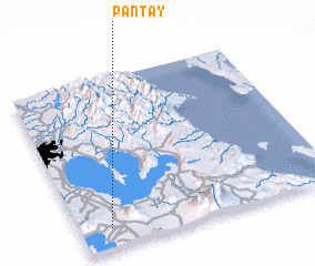 Places with similar names to Pantay, Philippines ::
Disclaimer :: Information on this page comes without warranty of any kind |
||
|
Where is Pantay? Elevation and coordinates ::
Latitude (lat): 14°7'3"N Longitude (lon): 121°7'16"E
Elevation (approx.): 132m (map arrows pan, magnifying glasses zoom) |
||
|
Visiting Pantay? Hotel/Accommodation ::
Book a hotel in Pantay Travel Guide ::
Buy a travel guide for Philippines rental cars ::
car rental offers GPS waypoint ::
download a GPX waypoint (PoI) of Pantay for your GPS receiver
|
||