|
search place name
|
||
Patiis (Rizal, Philippines)Patiis is a town in the Rizal region of Philippines. An overview map of the region around Patiis is displayed below.
regional and 3d topo map of Patiis, Philippines ::

Patiis airports ::
The nearest airport is MNL - Manila Ninoy Aquino Intl, located 25.3 km south west of Patiis.
Other airports nearby include BAG - Baguio (193.4 km north), Nearby towns ::
Maly (1.4km north west) //
Burgos (1.8km north) //
Dulong Bayan II (1.8km west) //
Guinayan (1.9km west) //
Manggahan (2.2km north) //
Dulong Bayan I (2.2km west) //
San Mateo (2.5km west) //
Guitnang Bayan I (2.8km west) //
San Jose (3.1km north) //
Rodriguez (3.3km north) //
Guitnang Bayan II (3.3km west) //
Rosario (3.4km north) //
General Geronimo (3.5km north) //
Balite (3.7km north) //
Ampid (3.6km south west) //
Santa Ana (3.7km south west) //
San Rafael (3.8km north) //
Cambal (3.7km south west) //
Tilagaan (3.9km south) //
Macabud (4.1km north west) //
Zaragoza (4.2km north east) //
Rodriquez (4.2km north east) //
Pintong Bocawe (4.3km east) //
San Isidro (5.0km north) //
Payatas (5.2km west) //
Nangka (5.4km south west) //
Wawa (5.4km north east) //
Parang (6.0km south west) //
Marikina Heights (6.7km south west) //
[all distances 'as the bird flies' and approximate] 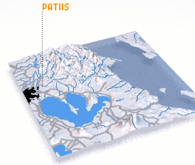 Places with similar names to Patiis, Philippines ::
Disclaimer :: Information on this page comes without warranty of any kind |
||
|
Where is Patiis? Elevation and coordinates ::
Latitude (lat): 14°42'10"N Longitude (lon): 121°8'40"E
Elevation (approx.): 55m (map arrows pan, magnifying glasses zoom) |
||
|
Visiting Patiis? Hotel/Accommodation ::
Book a hotel in Patiis Travel Guide ::
Buy a travel guide for Philippines rental cars ::
car rental offers GPS waypoint ::
download a GPX waypoint (PoI) of Patiis for your GPS receiver
|
||