|
search place name
|
||
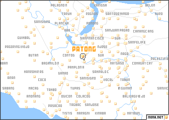
Patong (Camarines Sur, Philippines)Patong is a town in the Camarines Sur region of Philippines. An overview map of the region around Patong is displayed below.
regional and 3d topo map of Patong, Philippines ::
Patong airports ::
The nearest airport is KLO - Kalibo, located 228.3 km south of Patong.
Nearby towns ::
Batang (0.4km south) //
Cagbibi (1.3km north) //
Mangayawan (1.8km east) //
Iquin (2.1km east) //
Loob (2.1km east) //
Cagbugna (2.7km north) //
San Vicente (3.1km north west) //
Pamplona (3.2km south west) //
Contod (3.2km west) //
Burabod (3.3km south) //
Dahilig (3.6km east) //
Sua (3.6km east) //
Malbong (3.6km east) //
Sugnay (3.7km south east) //
San Nicolas (4.0km north) //
Mambulo Viejo (4.1km north west) //
San Jose (4.1km north east) //
Liniaga (4.1km north east) //
San Francisco (4.1km north east) //
San Rafael (4.1km south east) //
Danao (4.1km south west) //
San Juan (4.6km north west) //
Gainza (4.6km east) //
Salvacion (5.0km west) //
Sampaloc (5.2km south east) //
Fundado (5.2km south east) //
San Isidro (5.3km south) //
Malansad (5.4km north west) //
San Gabriel (5.6km south) //
[all distances 'as the bird flies' and approximate] 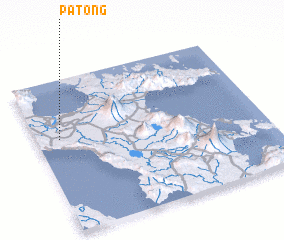 Places with similar names to Patong, Philippines ::
Disclaimer :: Information on this page comes without warranty of any kind |
||
|
Where is Patong? Elevation and coordinates ::
Latitude (lat): 13°37'0"N Longitude (lon): 123°6'0"E
Elevation (approx.): 2m (map arrows pan, magnifying glasses zoom) |
||
|
Visiting Patong? Hotel/Accommodation ::
Book a hotel in Patong Travel Guide ::
Buy a travel guide for Philippines rental cars ::
car rental offers GPS waypoint ::
download a GPX waypoint (PoI) of Patong for your GPS receiver
|
||