|
search place name
|
||
Payas (Pangasinan, Philippines)Payas is a town in the Pangasinan region of Philippines. An overview map of the region around Payas is displayed below.
regional and 3d topo map of Payas, Philippines ::

Payas airports ::
The nearest airport is BAG - Baguio, located 48.5 km north east of Payas.
Other airports nearby include MNL - Manila Ninoy Aquino Intl (175.6 km south), Nearby towns ::
Maro-Nong (1.2km west) //
Banaoang (1.8km east) //
Sapang (1.8km west) //
Maningding (1.9km north) //
Ventenilla (1.9km north) //
Malanay (1.9km north) //
Patayac (2.6km south east) //
Bulog (2.6km south west) //
Maticmatic (2.6km north east) //
Pecac (2.6km north east) //
Corangot (2.6km north east) //
Bansal West (2.6km north east) //
Dalongui (2.6km north west) //
Nilombot (2.6km north west) //
Santa Barbara (2.7km north) //
Tulao (3.6km north west) //
Ican (3.7km south) //
Bansal (3.6km east) //
Gasanga (3.7km north) //
Gugusang (3.7km north) //
Macabito (3.8km south west) //
Lokeb (4.1km south east) //
Cablong (4.0km south east) //
Carusucan (4.0km south east) //
Cawayan Bogtong (4.1km south west) //
Banzal (4.0km north east) //
Sanquil (4.0km north west) //
Calay (4.1km north west) //
Gatay (4.1km north west) //
[all distances 'as the bird flies' and approximate] 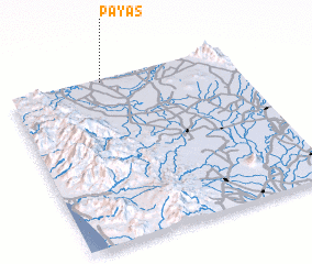 Places with similar names to Payas, Philippines ::
Disclaimer :: Information on this page comes without warranty of any kind |
||
|
Where is Payas? Elevation and coordinates ::
Latitude (lat): 15°59'0"N Longitude (lon): 120°25'0"E
Elevation (approx.): 7m (map arrows pan, magnifying glasses zoom) |
||
|
Visiting Payas? Hotel/Accommodation ::
Book a hotel in Payas Travel Guide ::
Buy a travel guide for Philippines rental cars ::
car rental offers GPS waypoint ::
download a GPX waypoint (PoI) of Payas for your GPS receiver
|
||