|
search place name
|
||
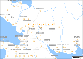
Pinagbalasianan (Quezon, Philippines)Pinagbalasianan is a town in the Quezon region of Philippines. An overview map of the region around Pinagbalasianan is displayed below.
regional and 3d topo map of Pinagbalasianan, Philippines ::
Pinagbalasianan airports ::
The nearest airport is MNL - Manila Ninoy Aquino Intl, located 157.0 km west of Pinagbalasianan.
Nearby towns ::
Gumihan (1.9km north) //
Cabibihan (2.7km south) //
Aloneros (3.9km south west) //
San Miguel (4.1km west) //
Atogan (4.1km west) //
Kabugwang (4.6km south) //
Mañgayaw (4.6km south) //
Apat (4.6km west) //
Viñas (4.9km south west) //
Malbog (5.0km east) //
Mataasnabasud (5.6km west) //
Pinaglandungan (5.9km west) //
San Pablo (5.9km west) //
Danlagan (6.3km south west) //
Maligaya (6.4km south) //
Manato (6.4km south east) //
Apad Quezon (6.5km north west) //
Apad Lutao (6.5km north west) //
San Lorenzo (7.2km west) //
Gapas (7.5km south) //
Mulay (7.5km south west) //
Patag (7.5km north west) //
Bagong Silang (7.8km east) //
Taguanmagayao (8.1km south east) //
Santo Domingo (8.0km south west) //
Kabagsangan (8.3km south) //
Maulawin (8.4km north) //
Hinabaan (8.8km south) //
Kuyaoyao (8.6km west) //
[all distances 'as the bird flies' and approximate] 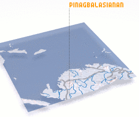 Places with similar names to Pinagbalasianan, Philippines :: Disclaimer :: Information on this page comes without warranty of any kind |
||
|
Where is Pinagbalasianan? Elevation and coordinates ::
Latitude (lat): 14°1'27"N Longitude (lon): 122°23'15"E
Elevation (approx.): 18m (map arrows pan, magnifying glasses zoom) |
||
|
Visiting Pinagbalasianan? Hotel/Accommodation ::
Book a hotel in Pinagbalasianan Travel Guide ::
Buy a travel guide for Philippines rental cars ::
car rental offers GPS waypoint ::
download a GPX waypoint (PoI) of Pinagbalasianan for your GPS receiver
|
||