|
search place name
|
||
Pinagsibaan (Batangas, Philippines)Pinagsibaan is a town in the Batangas region of Philippines. An overview map of the region around Pinagsibaan is displayed below.
regional and 3d topo map of Pinagsibaan, Philippines ::

Pinagsibaan airports ::
The nearest airport is MNL - Manila Ninoy Aquino Intl, located 80.9 km north west of Pinagsibaan.
Nearby towns ::
Macalamcam (1.3km north) //
Putingkahoy (2.4km south west) //
Maugat (2.4km north west) //
Alupay (2.5km west) //
Salao (3.7km north east) //
Calihan (4.9km north east) //
Natu (5.0km west) //
Deti (5.3km north) //
Palahanan Primero (5.2km east) //
Palahanan Segundo (5.2km east) //
Libato (5.4km south east) //
Santa Catalina Norte (5.5km north east) //
Baybayin (5.6km west) //
Balukbuk (5.7km west) //
Janaojanao (5.8km east) //
Bungo (6.1km north east) //
Sico Segundo (6.0km east) //
Mabunga (6.2km south west) //
Biting Bayan (6.4km north west) //
Behia (6.4km north) //
Mabato (6.3km west) //
Castillo (6.6km north west) //
San Antonio (6.7km north west) //
Bulakin (7.1km north) //
Sico Primero (7.0km east) //
Bulihan (7.2km north west) //
Mayuro (7.2km south west) //
Mabato (7.3km west) //
Marayquit (7.4km east) //
[all distances 'as the bird flies' and approximate] 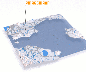 Places with similar names to Pinagsibaan, Philippines :: Disclaimer :: Information on this page comes without warranty of any kind |
||
|
Where is Pinagsibaan? Elevation and coordinates ::
Latitude (lat): 13°50'17"N Longitude (lon): 121°19'8"E
Elevation (approx.): 56m (map arrows pan, magnifying glasses zoom) |
||
|
Visiting Pinagsibaan? Hotel/Accommodation ::
Book a hotel in Pinagsibaan Travel Guide ::
Buy a travel guide for Philippines rental cars ::
car rental offers GPS waypoint ::
download a GPX waypoint (PoI) of Pinagsibaan for your GPS receiver
|
||