|
search place name
|
||
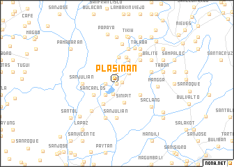
Plasinan (Nueva Ecija, Philippines)Plasinan is a town in the Nueva Ecija region of Philippines. An overview map of the region around Plasinan is displayed below.
regional and 3d topo map of Plasinan, Philippines ::
Plasinan airports ::
The nearest airport is MNL - Manila Ninoy Aquino Intl, located 84.0 km south of Plasinan.
Other airports nearby include BAG - Baguio (126.9 km north), Nearby towns ::
San Roque (NaNkm north) //
San Julian (NaNkm north) //
San Antonio Primero (NaNkm north) //
Cabiao (0.8km east) //
Santa Rita (1.8km south) //
San Antonio (1.8km west) //
Palasiban (1.9km north) //
San Fernando (2.5km north east) //
Santa Cruz (2.6km south west) //
Buliran Segundo (2.6km north east) //
Patalan (2.6km north east) //
Sinipit (3.3km south) //
San Vicente (3.9km south west) //
Santo Cristo (4.0km north east) //
San Carlos (4.0km south west) //
Buliran (4.1km north east) //
San Fernando (4.0km south east) //
Luyos (4.1km north) //
Entablado (4.4km north) //
San Roque (5.2km north east) //
San Julian (5.4km west) //
San Julian (5.6km south) //
Mamatad (5.8km south) //
Manatad (5.8km south) //
Calaba (5.8km north) //
Julo (5.8km north) //
Cocohan (5.7km east) //
Santo Cristo (5.9km north east) //
Concepcion (5.9km south west) //
[all distances 'as the bird flies' and approximate] 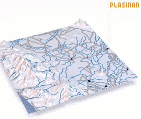 Places with similar names to Plasinan, Philippines :: Disclaimer :: Information on this page comes without warranty of any kind |
||
|
Where is Plasinan? Elevation and coordinates ::
Latitude (lat): 15°15'0"N Longitude (lon): 120°51'0"E
Elevation (approx.): 21m (map arrows pan, magnifying glasses zoom) |
||
|
Visiting Plasinan? Hotel/Accommodation ::
Book a hotel in Plasinan Travel Guide ::
Buy a travel guide for Philippines rental cars ::
car rental offers GPS waypoint ::
download a GPX waypoint (PoI) of Plasinan for your GPS receiver
|
||