|
search place name
|
||
Puyopoy (Ilocos Norte, Philippines)Puyopoy is a town in the Ilocos Norte region of Philippines. An overview map of the region around Puyopoy is displayed below.
regional and 3d topo map of Puyopoy, Philippines ::

Puyopoy airports ::
The nearest airport is BAG - Baguio, located 213.1 km south of Puyopoy.
Nearby towns ::
San Rafael (0.0km north) //
Balasbas (1.8km east) //
Manarang (1.9km south) //
Macupit (1.8km west) //
Santa Veronica (2.6km south west) //
Cabisocolan (3.7km south) //
Malampa (3.7km south) //
Dadaeman (3.5km west) //
Nagbanab (3.7km west) //
Bubon ni Posa (4.1km north east) //
Icas (4.1km north east) //
Nagparanga (4.1km north west) //
Nuestra Señora de la Paz (4.0km south west) //
Talatal (4.0km south west) //
Cadaratan (4.1km west) //
Pasuquin (5.1km north west) //
Karusiquis (5.1km north east) //
Santa Rosa (5.1km south west) //
Tippang (5.3km south west) //
Alsem (5.3km east) //
Salpad (5.6km south) //
Carusiban (5.3km west) //
Salsalamagui (5.8km south) //
Abec (5.8km north) //
Subic (5.8km north) //
San Alberto (5.8km south) //
Cadalman (5.8km north) //
Santo Tomas (5.6km west) //
Sulbec (5.9km north) //
[all distances 'as the bird flies' and approximate] 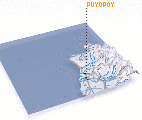 Places with similar names to Puyopoy, Philippines ::
Disclaimer :: Information on this page comes without warranty of any kind |
||
|
Where is Puyopoy? Elevation and coordinates ::
Latitude (lat): 18°18'0"N Longitude (lon): 120°39'0"E
Elevation (approx.): 77m (map arrows pan, magnifying glasses zoom) |
||
|
Visiting Puyopoy? Hotel/Accommodation ::
Book a hotel in Puyopoy Travel Guide ::
Buy a travel guide for Philippines rental cars ::
car rental offers GPS waypoint ::
download a GPX waypoint (PoI) of Puyopoy for your GPS receiver
|
||