|
search place name
|
||
Saba (Bataan, Philippines)Saba is a town in the Bataan region of Philippines. An overview map of the region around Saba is displayed below.
regional and 3d topo map of Saba, Philippines ::

Saba airports ::
The nearest airport is MNL - Manila Ninoy Aquino Intl, located 69.6 km south east of Saba.
Other airports nearby include BAG - Baguio (165.6 km north), Nearby towns ::
San Isidro (1.8km east) //
Malabu (2.6km north west) //
Santiago (2.9km north east) //
Balsik (3.2km south west) //
Pabanlag (3.5km north west) //
San Isidro (3.6km east) //
Calpuan (3.6km west) //
Tucop (3.6km west) //
Layac (3.6km south west) //
Pagalangang (3.6km west) //
San Roque Arbol (3.8km north east) //
Saba (4.0km south east) //
Masera Malapit (4.1km south east) //
San Pedro (4.1km north east) //
Dinalupihan (4.1km west) //
San Jose (4.2km west) //
San Rafael Buruya (4.5km south east) //
Anoun (4.6km north west) //
Masera Malayo (5.2km south east) //
Bodega (5.2km north west) //
Palilian (5.2km south west) //
Almacen (5.3km south) //
San Pablo Primero (5.3km north) //
Calañgain (5.3km east) //
Culis (5.5km south west) //
Gutad (5.6km north) //
San Roque (5.6km north) //
San Pedro Segundo (5.6km north east) //
Hermosa (5.8km south) //
[all distances 'as the bird flies' and approximate] 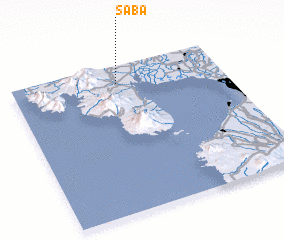 Places with similar names to Saba, Philippines ::
Disclaimer :: Information on this page comes without warranty of any kind |
||
|
Where is Saba? Elevation and coordinates ::
Latitude (lat): 14°53'0"N Longitude (lon): 120°30'0"E
Elevation (approx.): 12m (map arrows pan, magnifying glasses zoom) |
||
|
Visiting Saba? Hotel/Accommodation ::
Book a hotel in Saba Travel Guide ::
Buy a travel guide for Philippines rental cars ::
car rental offers GPS waypoint ::
download a GPX waypoint (PoI) of Saba for your GPS receiver
|
||