|
search place name
|
||
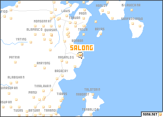
Salong (Iloilo, Philippines)Salong is a town in the Iloilo region of Philippines. An overview map of the region around Salong is displayed below.
regional and 3d topo map of Salong, Philippines ::
Salong airports ::
The nearest airport is BCD - Bacolod, located 85.3 km south of Salong.
Other airports nearby include KLO - Kalibo (90.1 km west), ILO - Iloilo (99.0 km south west), SJI - San Jose Antique (149.0 km south west), NOP - Masbate Mactan Cebu Intl (149.9 km south east), Nearby towns ::
Tanao (1.1km north west) //
Binon-an (1.4km north) //
Odioñgan (2.4km south west) //
Banban (3.0km north) //
Madanlog (3.4km west) //
Embarcadero (3.9km north west) //
Canas (4.5km west) //
Batad (5.5km north west) //
Tanza (5.5km north) //
Da-anbanua (5.8km north west) //
Bagacay (5.8km south west) //
Lumbia (6.4km north west) //
Santa Ana (6.5km north west) //
Bayas (7.1km north east) //
Cubay (7.2km south west) //
Bulaqueña (7.4km north) //
Botogon (7.4km north) //
Gogo (7.4km north) //
Bayuyan (7.4km north) //
Cabagohon (7.3km west) //
Estancia (7.4km north) //
Molbog (7.5km north west) //
Tacbuyan (7.5km north) //
Lonoy (7.5km north) //
Calañgag (7.7km north west) //
Tabuan (8.4km north) //
Bulak (8.3km north west) //
Pani-an (8.6km north) //
Taloto-an (8.6km south) //
[all distances 'as the bird flies' and approximate]  Places with similar names to Salong, Philippines ::
Disclaimer :: Information on this page comes without warranty of any kind |
||
|
Where is Salong? Elevation and coordinates ::
Latitude (lat): 11°23'1"N Longitude (lon): 123°8'45"E
Elevation (approx.): 13m (map arrows pan, magnifying glasses zoom) |
||
|
Visiting Salong? Hotel/Accommodation ::
Book a hotel in Salong Travel Guide ::
Buy a travel guide for Philippines rental cars ::
car rental offers GPS waypoint ::
download a GPX waypoint (PoI) of Salong for your GPS receiver
|
||