|
search place name
|
||
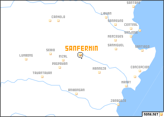
San Fermin (Davao Oriental, Philippines)San Fermin is a town in the Davao Oriental region of Philippines. An overview map of the region around San Fermin is displayed below.
regional and 3d topo map of San Fermin, Philippines ::
San Fermin airports ::
The nearest airport is CGY - Ladag Cagayan De Oro, located 238.9 km north west of San Fermin.
Nearby towns ::
Rizal (4.3km west) //
Manreza (5.0km south east) //
Pagpawan (5.4km west) //
Sebio (7.2km west) //
San Miguel (8.0km east) //
Anibongan (8.2km south) //
Mercedes (8.6km north east) //
Carmelo (10.2km north west) //
San Pedro (10.9km north east) //
Caniñgag (11.3km north west) //
[all distances 'as the bird flies' and approximate]  Places with similar names to San Fermin, Philippines ::
// San Fermín (CO)
// San Fermín (CO)
// San Fermin (MX)
// San Fermin (MX)
// San Fermin (MX)
// San Fermin (PH)
// San Fermín (AR)
// San Fermín (AR)
// San Fermin (BO)
// San Fermín (BO)
Disclaimer :: Information on this page comes without warranty of any kind |
||
|
Where is San Fermin? Elevation and coordinates ::
Latitude (lat): 7°16'19"N Longitude (lon): 126°26'56"E
Elevation (approx.): 390m (map arrows pan, magnifying glasses zoom) |
||
|
Visiting San Fermin? Hotel/Accommodation ::
Book a hotel in San Fermin Travel Guide ::
Buy a travel guide for Philippines rental cars ::
car rental offers GPS waypoint ::
download a GPX waypoint (PoI) of San Fermin for your GPS receiver
|
||