|
search place name
|
||
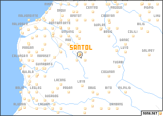
Santol (La Union, Philippines)Santol is a town in the La Union region of Philippines. An overview map of the region around Santol is displayed below.
regional and 3d topo map of Santol, Philippines ::
Santol airports ::
The nearest airport is BAG - Baguio, located 47.0 km south of Santol.
Nearby towns ::
Mangaan (0.9km south east) //
Lettac Sur (1.1km south west) //
Paagan (1.6km north east) //
Lettac Norte (1.6km north east) //
Ramot (1.6km north east) //
Bungcayo (3.4km north) //
Carcooy (3.4km north) //
Lipay (4.2km north west) //
Pao (4.2km north west) //
Butubut Sur (4.2km north west) //
Butubut Norte (4.5km north) //
Ar-Arumpang (4.8km west) //
Callat-Lugalog (5.2km north) //
Bigbiga (5.2km north) //
Corrooy (5.4km north west) //
Masupe (5.6km north west) //
Camiling (5.6km north west) //
Dirdirig (5.8km north west) //
Puto (6.1km north) //
Bungol (5.9km west) //
Laya (6.4km south) //
Bulbulala (6.8km north west) //
Patpata (6.8km north west) //
San Francisco (7.0km north) //
Sinapangan Sur (7.5km north) //
Baracbac Este (7.5km north) //
Sasaba (7.4km south east) //
Cogunan (7.4km south east) //
Lacong (7.6km south west) //
[all distances 'as the bird flies' and approximate] 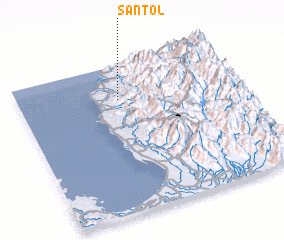 Places with similar names to Santol, Philippines ::
Disclaimer :: Information on this page comes without warranty of any kind |
||
|
Where is Santol? Elevation and coordinates ::
Latitude (lat): 16°46'16"N Longitude (lon): 120°27'34"E
Elevation (approx.): 67m (map arrows pan, magnifying glasses zoom) |
||
|
Visiting Santol? Hotel/Accommodation ::
Book a hotel in Santol Travel Guide ::
Buy a travel guide for Philippines rental cars ::
car rental offers GPS waypoint ::
download a GPX waypoint (PoI) of Santol for your GPS receiver
|
||