|
search place name
|
||
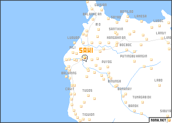
Sawi (Marinduque, Philippines)Sawi is a town in the Marinduque region of Philippines. An overview map of the region around Sawi is displayed below.
regional and 3d topo map of Sawi, Philippines ::
Sawi airports ::
The nearest airport is MNL - Manila Ninoy Aquino Intl, located 148.2 km north west of Sawi.
Other airports nearby include KLO - Kalibo (203.5 km south), Nearby towns ::
Tanza (1.1km north west) //
Boton (1.3km east) //
Daig (1.6km south) //
Tumapon (2.0km south) //
Boac (2.0km west) //
Balimbing (2.2km south east) //
Sibucaw (2.3km north) //
Tabi (2.4km west) //
Lupac (2.4km west) //
Duyay (2.4km west) //
Agumaymayan (2.4km west) //
Poctoy (2.4km west) //
Santol (2.4km west) //
Sabong (2.4km west) //
Agot (2.4km west) //
Daypay (2.4km west) //
Bamban (2.4km west) //
Danao (2.5km north east) //
Pawa (2.5km east) //
Buliasnin (2.6km north west) //
Bonbon (3.0km south east) //
Mogpog (3.2km north) //
Maybo (3.3km south) //
Payi (3.4km south east) //
Pili (3.4km north west) //
Tabigui (3.6km west) //
Mampaitan (3.7km north east) //
Panghinan (3.7km north east) //
Laylay (3.8km west) //
[all distances 'as the bird flies' and approximate] 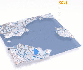 Places with similar names to Sawi, Philippines ::
Disclaimer :: Information on this page comes without warranty of any kind |
||
|
Where is Sawi? Elevation and coordinates ::
Latitude (lat): 13°26'48"N Longitude (lon): 121°51'20"E
Elevation (approx.): 23m (map arrows pan, magnifying glasses zoom) |
||
|
Visiting Sawi? Hotel/Accommodation ::
Book a hotel in Sawi Travel Guide ::
Buy a travel guide for Philippines rental cars ::
car rental offers GPS waypoint ::
download a GPX waypoint (PoI) of Sawi for your GPS receiver
|
||