|
search place name
|
||
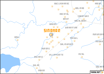
Sinamar (Isabela, Philippines)Sinamar is a town in the Isabela region of Philippines. An overview map of the region around Sinamar is displayed below.
regional and 3d topo map of Sinamar, Philippines ::
Sinamar airports ::
The nearest airport is BAG - Baguio, located 116.5 km south west of Sinamar.
Nearby towns ::
Caggong (0.0km north) //
Marasat Grande (1.2km south) //
Curag (1.7km south) //
Victoria (1.8km east) //
Daramuangan Norte (1.8km east) //
Mapuroc (1.8km west) //
Estrella (2.5km south) //
San Antonio (2.6km south west) //
San Mateo (2.9km south east) //
Dagupan (3.4km south) //
Aparri (3.6km north) //
Taotao (4.1km north east) //
Daramuangan Sur (4.2km east) //
Murong (5.5km south) //
Marasat Pequeño (5.6km east) //
Salinungan (6.4km south east) //
Diamantina (7.2km east) //
Apiat (7.4km north east) //
Villafuerte (7.5km south) //
Tandul (7.8km east) //
Macatal (8.6km north east) //
Oscariz (9.3km south west) //
[all distances 'as the bird flies' and approximate] 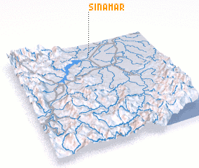 Places with similar names to Sinamar, Philippines ::
// San Mauro (IT)
// San Mauro (IT)
// San Mauro (IT)
// San Mauro (IT)
// San Mauro (IT)
// San Máuro (IT)
// Sin Nombre (CU)
// Ceanu Mare (RO)
// San Amaro (ES)
// San Mar (US)
Disclaimer :: Information on this page comes without warranty of any kind |
||
|
Where is Sinamar? Elevation and coordinates ::
Latitude (lat): 16°54'0"N Longitude (lon): 121°34'0"E
Elevation (approx.): 80m (map arrows pan, magnifying glasses zoom) |
||
|
Visiting Sinamar? Hotel/Accommodation ::
Book a hotel in Sinamar Travel Guide ::
Buy a travel guide for Philippines rental cars ::
car rental offers GPS waypoint ::
download a GPX waypoint (PoI) of Sinamar for your GPS receiver
|
||