|
search place name
|
||
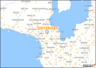
Sinturisan (Batangas, Philippines)Sinturisan is a town in the Batangas region of Philippines. An overview map of the region around Sinturisan is displayed below.
regional and 3d topo map of Sinturisan, Philippines ::
Sinturisan airports ::
The nearest airport is MNL - Manila Ninoy Aquino Intl, located 67.1 km north of Sinturisan.
Nearby towns ::
Halang (1.0km south west) //
Latag (1.0km south west) //
Santa Tereza (1.0km south west) //
Pooc (1.0km south west) //
Tolo (1.0km south west) //
Calañgay (1.2km north west) //
Carsuche (1.5km south east) //
Talang (1.7km north east) //
Malaue (1.7km north east) //
Mulauin (1.7km north east) //
Calampan (1.7km south east) //
Bañgin (2.1km north west) //
Luntal (2.2km north east) //
Kawit (2.4km west) //
Palanas (2.4km west) //
Laing (2.4km west) //
Igoigo (2.5km north west) //
Laguili (2.5km north west) //
Balañgon (2.5km north west) //
San Nicolas (2.6km north east) //
Tierra Alta (2.7km south) //
Niogan (2.7km south) //
Balisong (2.7km south) //
Mahabanglodlod (2.7km south) //
Pooc (2.7km south) //
Abelo (2.8km north east) //
Pooc (2.9km north) //
Panghulan (2.9km north) //
Agoncillo (3.1km north) //
[all distances 'as the bird flies' and approximate] 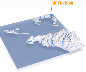 Places with similar names to Sinturisan, Philippines ::
// Saint-Ursanne (CH)
// Sanderson (US)
// Şendriceni (RO)
// Sanderson (US)
// SantʼArsenio (IT)
// Sanderson (US)
// Saint-Ursin (FR)
Disclaimer :: Information on this page comes without warranty of any kind |
||
|
Where is Sinturisan? Elevation and coordinates ::
Latitude (lat): 13°54'26"N Longitude (lon): 120°56'17"E
Elevation (approx.): 74m (map arrows pan, magnifying glasses zoom) |
||
|
Visiting Sinturisan? Hotel/Accommodation ::
Book a hotel in Sinturisan Travel Guide ::
Buy a travel guide for Philippines rental cars ::
car rental offers GPS waypoint ::
download a GPX waypoint (PoI) of Sinturisan for your GPS receiver
|
||