|
search place name
|
||
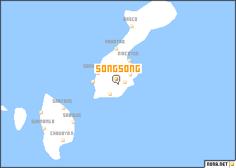
Songsong (Batanes, Philippines)Songsong is a town in the Batanes region of Philippines. An overview map of the region around Songsong is displayed below.
regional and 3d topo map of Songsong, Philippines ::
Songsong airports ::
The nearest airport is KYD - Lanyu, located 189.0 km north of Songsong.
Nearby towns ::
Itbud (1.1km east) //
Uyugan (2.0km south west) //
Imnajbu (2.4km north east) //
San Vicente (3.4km north west) //
Ivana (3.7km west) //
Riacoyde (4.1km north east) //
Mahatao (5.6km north) //
Sabidug (9.0km south west) //
Sabtang (8.9km south west) //
[all distances 'as the bird flies' and approximate] 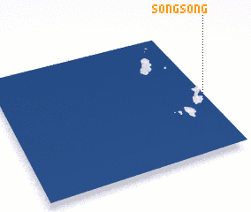 Places with similar names to Songsong, Philippines ::
// Cinco Cinco (PH)
// Suangsang (MM)
// Suangzang (MM)
// Sungai Sungai (MY)
// Soeng Sang (TH)
// Zingzinga (IQ)
// Sangasangu (CD)
// Songsāng (IN)
// Songsong (ID)
// Sungsang (ID)
Disclaimer :: Information on this page comes without warranty of any kind |
||
|
Where is Songsong? Elevation and coordinates ::
Latitude (lat): 20°22'0"N Longitude (lon): 121°57'0"E
Elevation (approx.): 119m (map arrows pan, magnifying glasses zoom) |
||
|
Visiting Songsong? Hotel/Accommodation ::
Book a hotel in Songsong Travel Guide ::
Buy a travel guide for Philippines rental cars ::
car rental offers GPS waypoint ::
download a GPX waypoint (PoI) of Songsong for your GPS receiver
|
||