|
search place name
|
||
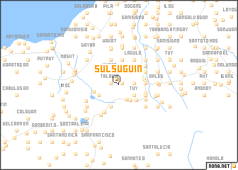
Sulsuguin (Laguna, Philippines)Sulsuguin is a town in the Laguna region of Philippines. An overview map of the region around Sulsuguin is displayed below.
regional and 3d topo map of Sulsuguin, Philippines ::
Sulsuguin airports ::
The nearest airport is MNL - Manila Ninoy Aquino Intl, located 57.0 km north west of Sulsuguin.
Nearby towns ::
Sabang (0.6km north east) //
Maiit (0.6km north east) //
Antipolo (0.6km north east) //
Entablado (0.6km north east) //
Alumbrado (0.6km north east) //
Talahib (1.3km west) //
Balayong (2.2km north) //
Lawaguin (2.2km north) //
Yucos (2.3km east) //
Yucos (2.5km north west) //
Talaga (2.6km south east) //
Tuy (2.8km south east) //
Tala (2.8km south east) //
Laguan (2.8km south east) //
Putol (2.8km south east) //
Banilad (2.8km south east) //
Rizal (3.0km south east) //
Bunga (3.1km north east) //
Cabuyew (3.1km north east) //
San Lorenzo (3.5km south west) //
Pook (3.6km south east) //
Santo Angel (3.7km south) //
Bayaquitos (4.0km north) //
Sibulan (4.0km north) //
Inlolopez (3.9km east) //
Santa Catalina (3.9km west) //
Lawaguin (4.2km north) //
Nagcarlan (4.1km east) //
Balite (4.1km east) //
[all distances 'as the bird flies' and approximate] 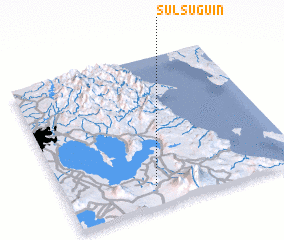 Places with similar names to Sulsuguin, Philippines ::
Disclaimer :: Information on this page comes without warranty of any kind |
||
|
Where is Sulsuguin? Elevation and coordinates ::
Latitude (lat): 14°7'52"N Longitude (lon): 121°22'43"E
Elevation (approx.): 197m (map arrows pan, magnifying glasses zoom) |
||
|
Visiting Sulsuguin? Hotel/Accommodation ::
Book a hotel in Sulsuguin Travel Guide ::
Buy a travel guide for Philippines rental cars ::
car rental offers GPS waypoint ::
download a GPX waypoint (PoI) of Sulsuguin for your GPS receiver
|
||