|
search place name
|
||
Tablac (Ilocos Sur, Philippines)Tablac is a town in the Ilocos Sur region of Philippines. An overview map of the region around Tablac is displayed below.
regional and 3d topo map of Tablac, Philippines ::

Tablac airports ::
The nearest airport is BAG - Baguio, located 94.3 km south of Tablac.
Nearby towns ::
Salvador Segundo (0.0km north) //
Bisangol (1.9km north) //
Lupes (1.9km north) //
Montero (1.9km north) //
Banayoyo (1.9km north) //
Bagbagotot (1.9km north) //
Lopez (1.8km east) //
McKinley (1.8km east) //
Lintic (1.8km east) //
Calimogtong (1.9km south) //
Sampatingan (2.1km east) //
Balingaoan (2.7km west) //
San Jose de Bugnay (2.8km east) //
Banbanaal (3.0km east) //
Elefante (3.4km north) //
Bagani (3.3km south west) //
Langlangca (3.5km west) //
San Agustin (3.5km west) //
Bagar (3.5km west) //
Pila (3.7km north) //
Cadanglaan (3.7km north) //
Casilagan (3.7km north) //
Guardia (3.7km north) //
Pagangpang (3.6km south east) //
Guimod (3.7km south) //
Rubio (3.7km south) //
Patac Barangan (3.7km south) //
Galimuyod (3.8km south) //
Balingaoan (4.0km north west) //
[all distances 'as the bird flies' and approximate] 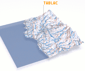 Places with similar names to Tablac, Philippines ::
Disclaimer :: Information on this page comes without warranty of any kind |
||
|
Where is Tablac? Elevation and coordinates ::
Latitude (lat): 17°13'0"N Longitude (lon): 120°29'0"E
Elevation (approx.): 92m (map arrows pan, magnifying glasses zoom) |
||
|
Visiting Tablac? Hotel/Accommodation ::
Book a hotel in Tablac Travel Guide ::
Buy a travel guide for Philippines rental cars ::
car rental offers GPS waypoint ::
download a GPX waypoint (PoI) of Tablac for your GPS receiver
|
||