|
search place name
|
||
Tabo (Leyte, Philippines)Tabo is a town in the Leyte region of Philippines. An overview map of the region around Tabo is displayed below.
regional and 3d topo map of Tabo, Philippines ::

Tabo airports ::
The nearest airport is TAC - Tacloban Daniel Z Romualdez, located 31.1 km north of Tabo.
Other airports nearby include NOP - Masbate Mactan Cebu Intl (130.8 km south west), DGT - Dumaguete (256.8 km south west), Nearby towns ::
Cabaracan (1.8km west) //
Cabarasan (1.9km south) //
Tabuk (1.8km east) //
Rawis (1.8km east) //
Guinhalinan (1.8km east) //
Malacanding (1.8km east) //
Cabacuñgan (1.9km south) //
Mojon (2.6km south west) //
Batog (2.6km south west) //
Mojon (2.6km north west) //
Arabo (2.6km south west) //
Calipayan (2.6km north east) //
Lanajon (2.6km south east) //
Alegre (2.6km south east) //
Santo Niño (3.5km south west) //
Julita (3.6km north west) //
Tagkip (3.6km west) //
Talisay (3.7km south) //
Canmangui (3.7km north) //
Mat-i (3.7km north) //
Cogon Bincay (3.6km east) //
Wilson (3.6km east) //
Caridad (3.7km west) //
Kapakunan (4.1km south west) //
Alegria (4.1km south west) //
Gebuga (4.1km south west) //
Caloktogan (4.1km south west) //
Kangabao (4.1km south west) //
Cabagtan (4.1km north west) //
[all distances 'as the bird flies' and approximate] 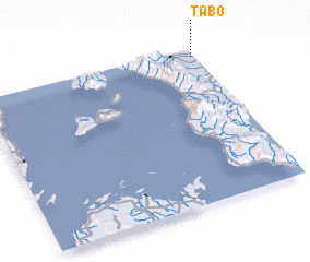 Places with similar names to Tabo, Philippines ::
Disclaimer :: Information on this page comes without warranty of any kind |
||
|
Where is Tabo? Elevation and coordinates ::
Latitude (lat): 10°57'0"N Longitude (lon): 124°59'0"E
Elevation (approx.): 17m (map arrows pan, magnifying glasses zoom) |
||
|
Visiting Tabo? Hotel/Accommodation ::
Book a hotel in Tabo Travel Guide ::
Buy a travel guide for Philippines rental cars ::
car rental offers GPS waypoint ::
download a GPX waypoint (PoI) of Tabo for your GPS receiver
|
||