|
search place name
|
||
Talahib (Laguna, Philippines)Talahib is a town in the Laguna region of Philippines. An overview map of the region around Talahib is displayed below.
regional and 3d topo map of Talahib, Philippines ::

Talahib airports ::
The nearest airport is MNL - Manila Ninoy Aquino Intl, located 59.1 km north west of Talahib.
Nearby towns ::
Talaungan (1.8km east) //
Canluran Talaoñgan (3.6km south east) //
Tibatib (3.7km south) //
Mahipon (4.1km south west) //
Pao-win (4.1km south west) //
Layasin (4.1km south west) //
Cansuso (4.1km south west) //
Anglas (4.0km south west) //
Cavinti (4.4km south) //
Santo Angel (4.6km north) //
Sala (5.0km north) //
Magalolong (5.2km north east) //
Yunot (5.2km north east) //
Duhat (5.2km south west) //
Maytalang (5.4km west) //
Malakaban (5.6km north) //
Sisilmin (5.6km south) //
Silañgan Talaoñgan (5.7km east) //
Duhatan (5.7km west) //
Malaking Pulo (5.7km east) //
Bukal (6.2km south east) //
San Juan (6.2km north west) //
San Antonio (6.3km north) //
Lumban (6.4km west) //
Layog (6.6km south) //
Labayo (6.7km south) //
Halang (6.5km north west) //
Lunao (6.6km north west) //
Udia (6.8km south) //
[all distances 'as the bird flies' and approximate] 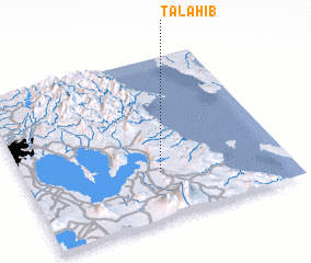 Places with similar names to Talahib, Philippines ::
// Tall Ḩabbū (SY)
// Talah Ou Abbou (MA)
// Talahib (PH)
// Talahib (PH)
// Talahib (PH)
// Talahib (PH)
// Dalai Hob (CN)
// Tala Hiba (DZ)
Disclaimer :: Information on this page comes without warranty of any kind |
||
|
Where is Talahib? Elevation and coordinates ::
Latitude (lat): 14°17'0"N Longitude (lon): 121°31'0"E
Elevation (approx.): 288m (map arrows pan, magnifying glasses zoom) |
||
|
Visiting Talahib? Hotel/Accommodation ::
Book a hotel in Talahib Travel Guide ::
Buy a travel guide for Philippines rental cars ::
car rental offers GPS waypoint ::
download a GPX waypoint (PoI) of Talahib for your GPS receiver
|
||