|
search place name
|
||
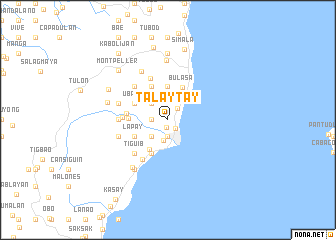
Talaytay (Cebu, Philippines)Talaytay is a town in the Cebu region of Philippines. An overview map of the region around Talaytay is displayed below.
regional and 3d topo map of Talaytay, Philippines ::
Talaytay airports ::
The nearest airport is NOP - Masbate Mactan Cebu Intl, located 61.3 km north east of Talaytay.
Other airports nearby include DGT - Dumaguete (70.7 km south west), BCD - Bacolod (110.2 km north west), ILO - Iloilo (146.4 km north west), CGY - Ladag Cagayan De Oro (198.3 km south east), Nearby towns ::
Homgao (0.8km south) //
Langtad (1.3km south east) //
Binlod (1.7km north east) //
Jampang (1.8km west) //
Jomgao (1.9km south) //
Media (1.9km south) //
Canbantug (1.9km south) //
Argao (2.3km south) //
Bug-ot (2.6km south west) //
Mabasa (2.6km north west) //
Sumaguan (3.7km north) //
Alcoy (3.8km south west) //
Bulasa (4.0km north east) //
Langub (4.1km north west) //
Capio-an (4.1km north west) //
Tulic (4.1km south west) //
Conalum (4.1km north west) //
Ubaub (4.1km north west) //
Lapay (4.1km south west) //
Panadtaran (4.4km west) //
Usmad (4.6km west) //
Sua (5.0km north) //
Katang (5.0km west) //
Bogo (5.2km south west) //
Colawin (5.2km north west) //
Anajao (5.2km south west) //
Tiguib (5.2km south west) //
Calagasan (5.5km west) //
Kambantug (5.8km west) //
[all distances 'as the bird flies' and approximate] 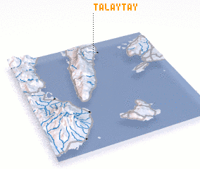 Places with similar names to Talaytay, Philippines ::
Disclaimer :: Information on this page comes without warranty of any kind |
||
|
Where is Talaytay? Elevation and coordinates ::
Latitude (lat): 9°54'0"N Longitude (lon): 123°36'0"E
Elevation (approx.): 29m (map arrows pan, magnifying glasses zoom) |
||
|
Visiting Talaytay? Hotel/Accommodation ::
Book a hotel in Talaytay Travel Guide ::
Buy a travel guide for Philippines rental cars ::
car rental offers GPS waypoint ::
download a GPX waypoint (PoI) of Talaytay for your GPS receiver
|
||