|
search place name
|
||
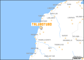
Talubotubo (Misamis Oriental, Philippines)Talubotubo is a town in the Misamis Oriental region of Philippines. An overview map of the region around Talubotubo is displayed below.
regional and 3d topo map of Talubotubo, Philippines ::
Talubotubo airports ::
The nearest airport is CGY - Ladag Cagayan De Oro, located 33.7 km east of Talubotubo.
Other airports nearby include LGP - Legazpi Pagadian (119.0 km south west), DGT - Dumaguete (145.6 km north west), CEB - Cebu Cotabato (146.4 km south), NOP - Masbate Mactan Cebu Intl (204.9 km north), Nearby towns ::
Tawan-Tawan (1.2km south east) //
Initao (1.7km north west) //
Gimampang (1.9km south west) //
Kanitoon (3.0km north) //
Pagohan (4.5km south west) //
Maputi (4.9km south west) //
Tubigan (5.2km north) //
Tagbalugo Mati (5.6km south) //
Lubluban (6.0km north east) //
Naauan (6.6km south west) //
Gimaylan (8.3km north east) //
Libertad (9.6km north east) //
Tagbalogo (10.9km south east) //
[all distances 'as the bird flies' and approximate] 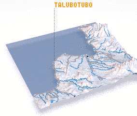 Places with similar names to Talubotubo, Philippines ::
// Deylouba Débé (ML)
// Talobatib (PH)
Disclaimer :: Information on this page comes without warranty of any kind |
||
|
Where is Talubotubo? Elevation and coordinates ::
Latitude (lat): 8°29'7"N Longitude (lon): 124°18'47"E
Elevation (approx.): 101m (map arrows pan, magnifying glasses zoom) |
||
|
Visiting Talubotubo? Hotel/Accommodation ::
Book a hotel in Talubotubo Travel Guide ::
Buy a travel guide for Philippines rental cars ::
car rental offers GPS waypoint ::
download a GPX waypoint (PoI) of Talubotubo for your GPS receiver
|
||