|
search place name
|
||
Tamac (Abra, Philippines)Tamac is a town in the Abra region of Philippines. An overview map of the region around Tamac is displayed below.
regional and 3d topo map of Tamac, Philippines ::

Tamac airports ::
The nearest airport is BAG - Baguio, located 102.4 km south of Tamac.
Nearby towns ::
Langoyan (1.8km east) //
Sibsibo (2.5km west) //
Guidaquid (3.5km west) //
Guyen (3.7km north) //
Paracad (4.0km north west) //
Mateo (4.1km north east) //
Lancuas (5.1km south) //
Manangduan (5.1km north west) //
Pang-ot (5.1km north west) //
Nanangduan (5.1km north west) //
Palo (5.6km north) //
Villavieja (5.6km north) //
Bol-lilising (5.6km north) //
Agomanay (5.3km east) //
Banucal (5.5km west) //
Kalumsing (5.6km west) //
Asin (5.6km west) //
Tubtubo (5.6km east) //
Matinobo (5.6km east) //
Lul-Lono (5.9km east) //
Dalit (6.6km north west) //
Ocup (6.6km north west) //
Masiosioay (6.6km south east) //
Lieseb (6.6km south east) //
Tuquipa (6.5km north east) //
Baang (7.0km south) //
Panpanaoil (7.4km south) //
Bessang (7.1km west) //
Catsa (7.2km north east) //
[all distances 'as the bird flies' and approximate] 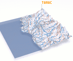 Places with similar names to Tamac, Philippines ::
Disclaimer :: Information on this page comes without warranty of any kind |
||
|
Where is Tamac? Elevation and coordinates ::
Latitude (lat): 17°18'0"N Longitude (lon): 120°36'0"E
Elevation (approx.): 437m (map arrows pan, magnifying glasses zoom) |
||
|
Visiting Tamac? Hotel/Accommodation ::
Book a hotel in Tamac Travel Guide ::
Buy a travel guide for Philippines rental cars ::
car rental offers GPS waypoint ::
download a GPX waypoint (PoI) of Tamac for your GPS receiver
|
||