|
search place name
|
||
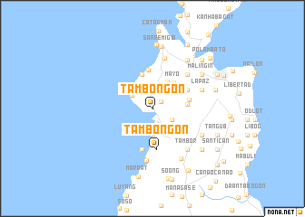
Tambongon (Cebu, Philippines)Tambongon is a town in the Cebu region of Philippines. An overview map of the region around Tambongon is displayed below.
regional and 3d topo map of Tambongon, Philippines ::
Tambongon airports ::
The nearest airport is NOP - Masbate Mactan Cebu Intl, located 78.2 km south of Tambongon.
Other airports nearby include BCD - Bacolod (116.6 km west), TAC - Tacloban Daniel Z Romualdez (122.4 km east), ILO - Iloilo (154.8 km west), KLO - Kalibo (184.8 km north west), Nearby towns ::
To-ong (1.3km north east) //
Lambusan (1.9km south) //
Male (2.6km north west) //
Tinubdan (2.7km south east) //
Anapog (2.9km north west) //
Batad (3.1km south) //
Busugon (3.2km south) //
Maño (3.7km north east) //
Kayam (3.9km north west) //
Mayo (4.1km north east) //
Camay (4.2km east) //
Cance (4.2km east) //
Malatapay (4.4km north) //
Biasong (4.4km north) //
Lacaron (4.5km east) //
Bancasan (4.7km north) //
Lawis (4.8km north east) //
Cadaatan (4.8km north east) //
Tambongon (5.1km south) //
Victoria (5.3km south) //
Binabag (5.9km north east) //
Sansan (6.4km north) //
Aningalan (6.5km south) //
Guadalupe (6.4km east) //
Lamac (6.4km east) //
La Paz (6.4km east) //
Tambor (6.6km south east) //
Canangay (6.8km south east) //
Tijib (7.0km south east) //
[all distances 'as the bird flies' and approximate]  Places with similar names to Tambongon, Philippines ::
// Timon'kino (RU)
// Dimankin (PH)
// Tamangon (MM)
// Dumnikona (BD)
// Demungan (ID)
// Tambangan (ID)
// Tambangan (ID)
// Tambangan (ID)
// Tambangan (ID)
// Tumbang Ane (ID)
Disclaimer :: Information on this page comes without warranty of any kind |
||
|
Where is Tambongon? Elevation and coordinates ::
Latitude (lat): 11°0'45"N Longitude (lon): 123°55'42"E
Elevation (approx.): 12m (map arrows pan, magnifying glasses zoom) |
||
|
Visiting Tambongon? Hotel/Accommodation ::
Book a hotel in Tambongon Travel Guide ::
Buy a travel guide for Philippines rental cars ::
car rental offers GPS waypoint ::
download a GPX waypoint (PoI) of Tambongon for your GPS receiver
|
||