|
search place name
|
||
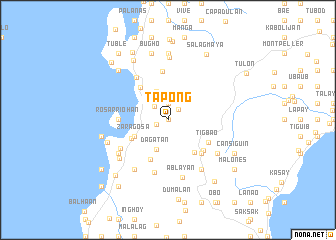
Tapong (Cebu, Philippines)Tapong is a town in the Cebu region of Philippines. An overview map of the region around Tapong is displayed below.
regional and 3d topo map of Tapong, Philippines ::
Tapong airports ::
The nearest airport is DGT - Dumaguete, located 62.5 km south of Tapong.
Other airports nearby include NOP - Masbate Mactan Cebu Intl (76.1 km north east), BCD - Bacolod (100.5 km north west), ILO - Iloilo (133.7 km north west), SJI - San Jose Antique (191.1 km north west), Nearby towns ::
San Isidro (0.0km north) //
Malhiao (1.4km south west) //
Bugas (1.7km north east) //
Manduyong (1.9km north) //
Busay (2.1km north west) //
Agbalanga (3.4km north) //
Dagatan (3.5km south) //
Candiis (4.1km south west) //
Zaragosa (4.1km south west) //
Balahaan (4.1km south west) //
Basak (4.1km south west) //
Suhoton (4.1km south west) //
Basiao (4.1km south west) //
Solsogan (4.1km south west) //
Ginablan (4.1km south west) //
Calangcang (4.1km south west) //
Badian (4.5km south west) //
Santicon (4.7km south east) //
Balabagon (4.7km north west) //
Talayong (4.8km south west) //
Manlapay (5.2km south east) //
Tigbao (5.2km south east) //
Salug (5.2km south east) //
Batadbatad (5.4km north) //
Rosarriohan (5.5km west) //
Tomonoy (5.8km north west) //
Tubod (6.1km south) //
Banhigan (6.1km south west) //
Ablayan (6.6km south) //
[all distances 'as the bird flies' and approximate]  Places with similar names to Tapong, Philippines ::
Disclaimer :: Information on this page comes without warranty of any kind |
||
|
Where is Tapong? Elevation and coordinates ::
Latitude (lat): 9°53'0"N Longitude (lon): 123°26'0"E
Elevation (approx.): 231m (map arrows pan, magnifying glasses zoom) |
||
|
Visiting Tapong? Hotel/Accommodation ::
Book a hotel in Tapong Travel Guide ::
Buy a travel guide for Philippines rental cars ::
car rental offers GPS waypoint ::
download a GPX waypoint (PoI) of Tapong for your GPS receiver
|
||