|
search place name
|
||
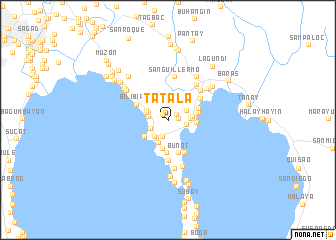
Tatala (Rizal, Philippines)Tatala is a town in the Rizal region of Philippines. An overview map of the region around Tatala is displayed below.
regional and 3d topo map of Tatala, Philippines ::
Tatala airports ::
The nearest airport is MNL - Manila Ninoy Aquino Intl, located 20.3 km west of Tatala.
Other airports nearby include BAG - Baguio (218.7 km north), Nearby towns ::
Balatic-Malaki (0.9km north west) //
Mambog (1.1km north east) //
Kay Ticulio (1.2km east) //
Tutulo (1.9km south) //
San Guillermo (1.9km south) //
Calumpang (2.1km south west) //
Kalawaan (2.1km west) //
Looc (2.1km east) //
Del Remedio (2.2km north east) //
Pantok (2.3km west) //
Libid (2.4km south west) //
Binangonan (2.4km south west) //
Real (2.4km east) //
Darangan (2.5km west) //
Cardona (2.6km east) //
Palangoy (2.7km north west) //
Lunsad (2.7km south west) //
Gumising Ka Bayan (3.0km south west) //
Mahabang Parang (3.0km south west) //
Matikiw (3.0km south west) //
Kuhala (3.0km east) //
Subay (3.0km east) //
San Roque (3.0km east) //
Dalig (3.0km east) //
Bombongan (3.1km north east) //
Gupiing (3.2km south) //
Patunhay (3.3km east) //
Calahan (3.4km east) //
Pila (3.7km south) //
[all distances 'as the bird flies' and approximate] 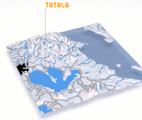 Places with similar names to Tatala, Philippines ::
Disclaimer :: Information on this page comes without warranty of any kind |
||
|
Where is Tatala? Elevation and coordinates ::
Latitude (lat): 14°28'57"N Longitude (lon): 121°12'21"E
Elevation (approx.): 85m (map arrows pan, magnifying glasses zoom) |
||
|
Visiting Tatala? Hotel/Accommodation ::
Book a hotel in Tatala Travel Guide ::
Buy a travel guide for Philippines rental cars ::
car rental offers GPS waypoint ::
download a GPX waypoint (PoI) of Tatala for your GPS receiver
|
||