|
search place name
|
||
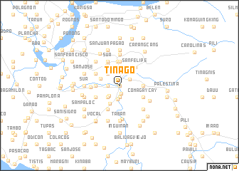
Tinago (Naga, Philippines)Tinago is a town in the Naga region of Philippines. An overview map of the region around Tinago is displayed below.
regional and 3d topo map of Tinago, Philippines ::
Tinago airports ::
The nearest airport is KLO - Kalibo, located 231.5 km south of Tinago.
Nearby towns ::
Sabang (0.0km north) //
Santa Cruz (0.0km north) //
Tabuco (0.0km north) //
Naga (0.3km north west) //
Mabolo (1.3km south) //
Marupit (1.8km west) //
San Francisco (1.8km west) //
San Roque (1.8km west) //
Bagumbayan (1.8km west) //
Dalipay (1.9km south) //
Concepcion (1.9km north east) //
Milaor (2.2km south) //
Peñafrancia (2.3km north east) //
Lipot (2.3km south west) //
Tarusanan (2.6km north west) //
Dugcal (2.6km north west) //
Borongborogñan (2.6km south west) //
Maydaso (2.6km south west) //
Camaligan (3.0km west) //
Balagbag (3.2km south west) //
Tarosanan (3.6km west) //
Cabugao (3.6km west) //
San Miguel (3.7km north) //
Concepcion (3.6km east) //
Baras (3.7km north) //
San Felipe (3.7km north east) //
Santa Cruz (3.9km north west) //
Gogon (4.1km north west) //
San Francisco (4.1km north west) //
[all distances 'as the bird flies' and approximate] 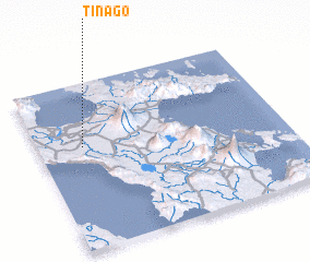 Places with similar names to Tinago, Philippines ::
Disclaimer :: Information on this page comes without warranty of any kind |
||
|
Where is Tinago? Elevation and coordinates ::
Latitude (lat): 13°37'0"N Longitude (lon): 123°11'0"E
Elevation (approx.): 5m (map arrows pan, magnifying glasses zoom) |
||
|
Visiting Tinago? Hotel/Accommodation ::
Book a hotel in Tinago Travel Guide ::
Buy a travel guide for Philippines rental cars ::
car rental offers GPS waypoint ::
download a GPX waypoint (PoI) of Tinago for your GPS receiver
|
||