|
search place name
|
||
Tinuran (Iloilo, Philippines)Tinuran is a town in the Iloilo region of Philippines. An overview map of the region around Tinuran is displayed below.
regional and 3d topo map of Tinuran, Philippines ::

Tinuran airports ::
The nearest airport is ILO - Iloilo, located 22.5 km north west of Tinuran.
Other airports nearby include BCD - Bacolod (23.8 km east), SJI - San Jose Antique (87.6 km west), KLO - Kalibo (125.1 km north), NOP - Masbate Mactan Cebu Intl (142.0 km east), Nearby towns ::
Suclaran (1.5km north) //
Cabano (1.6km south west) //
Paos (1.8km west) //
Barcelona (3.1km south west) //
Pagnaluton (4.1km north west) //
Libas (4.5km north) //
Aguilar (5.4km north west) //
South Valencia (5.6km north) //
Mantaza (5.6km north) //
San Enrique (5.6km north) //
Gaban (6.2km west) //
Igcawayan (6.8km south west) //
East Valencia (7.5km north) //
Banbanan (7.8km north west) //
Constancia (8.2km west) //
Sebario (9.2km south west) //
Piña (9.5km north west) //
Nazaret (9.8km north west) //
[all distances 'as the bird flies' and approximate] 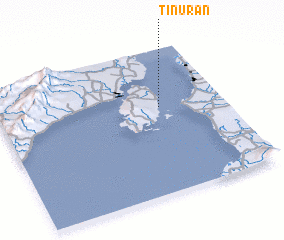 Places with similar names to Tinuran, Philippines ::
// Dinghorn (DE)
// Donnern (DE)
// Tannern (DE)
// Dīnārān (IQ)
// Dunăreni (RO)
// Dunăreni (RO)
// Tunarii Noi (RO)
// Dīnārān (IR)
// Dīnārān (IR)
// Tanahrenah (ID)
Disclaimer :: Information on this page comes without warranty of any kind |
||
|
Where is Tinuran? Elevation and coordinates ::
Latitude (lat): 10°36'0"N Longitude (lon): 122°43'0"E
Elevation (approx.): -32768m (map arrows pan, magnifying glasses zoom) |
||
|
Visiting Tinuran? Hotel/Accommodation ::
Book a hotel in Tinuran Travel Guide ::
Buy a travel guide for Philippines rental cars ::
car rental offers GPS waypoint ::
download a GPX waypoint (PoI) of Tinuran for your GPS receiver
|
||