|
search place name
|
||
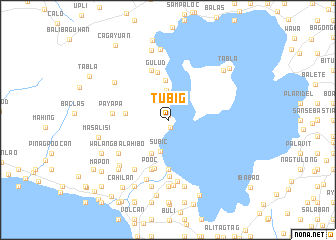
Tubig (Batangas, Philippines)Tubig is a town in the Batangas region of Philippines. An overview map of the region around Tubig is displayed below.
regional and 3d topo map of Tubig, Philippines ::
Tubig airports ::
The nearest airport is MNL - Manila Ninoy Aquino Intl, located 58.6 km north of Tubig.
Nearby towns ::
Bilibinuang (0.6km north) //
Manalaw (0.9km south) //
Banga (3.2km north) //
Subic (3.6km south) //
Pahulan (4.1km south west) //
Bosoboso (4.4km north) //
Pinagcurusan (4.7km west) //
Gulud (5.4km north) //
Balete (5.6km south) //
Pansipit (5.6km south) //
Agoncillo (5.6km south) //
Bugaan (5.8km north) //
Panghulan (5.8km south) //
Pooc (5.8km south) //
Payapa (6.0km west) //
San Nicolas (6.3km south) //
Walangbalahibo (6.5km south west) //
Balibago (6.6km south west) //
Coralnamunti (6.6km south west) //
Pamiga (6.6km south west) //
Abelo (6.9km south) //
Bañgin (7.0km south) //
Balakit (7.2km north west) //
Luntal (7.4km south) //
Malaue (7.4km south) //
Talang (7.4km south) //
Mulauin (7.4km south) //
Dayapan (7.3km south west) //
Hipit (7.6km south) //
[all distances 'as the bird flies' and approximate] 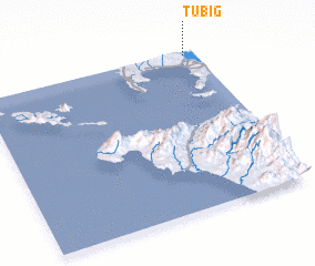 Places with similar names to Tubig, Philippines ::
Disclaimer :: Information on this page comes without warranty of any kind |
||
|
Where is Tubig? Elevation and coordinates ::
Latitude (lat): 13°59'0"N Longitude (lon): 120°57'0"E
Elevation (approx.): 41m (map arrows pan, magnifying glasses zoom) |
||
|
Visiting Tubig? Hotel/Accommodation ::
Book a hotel in Tubig Travel Guide ::
Buy a travel guide for Philippines rental cars ::
car rental offers GPS waypoint ::
download a GPX waypoint (PoI) of Tubig for your GPS receiver
|
||