|
search place name
|
||
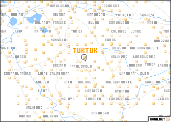
Tuktuk (Pangasinan, Philippines)Tuktuk is a town in the Pangasinan region of Philippines. An overview map of the region around Tuktuk is displayed below.
regional and 3d topo map of Tuktuk, Philippines ::
Tuktuk airports ::
The nearest airport is BAG - Baguio, located 58.3 km north east of Tuktuk.
Other airports nearby include MNL - Manila Ninoy Aquino Intl (168.4 km south east), Nearby towns ::
Turac (1.2km west) //
Magtaking (1.8km west) //
Anlabo (1.8km west) //
Mapolopolo (1.8km west) //
Cobol (1.9km north) //
Maresum (1.9km south) //
Anulid (1.8km east) //
Dumpay (2.3km south) //
Mapolopolo (2.3km south west) //
Coliling (2.6km north west) //
Vigá (2.6km north west) //
Anamboñgan (2.6km south west) //
Angalatan (2.6km south west) //
Alacan (2.6km north east) //
Cabueldatan (2.6km south east) //
Talimit (2.9km south east) //
Pasima (3.3km north east) //
Carlos (3.7km north) //
Maculnet (3.7km north) //
Bayoyong (3.7km south) //
Darise (3.7km south) //
Boquig (4.1km north west) //
Anomlid (4.1km south west) //
Palospos (4.1km south west) //
Navatat (4.1km south east) //
Caingal (4.0km north west) //
Tokingal (4.0km north west) //
Nancapian (4.0km north east) //
Nalsian (4.0km north east) //
[all distances 'as the bird flies' and approximate]  Places with similar names to Tuktuk, Philippines ::
Disclaimer :: Information on this page comes without warranty of any kind |
||
|
Where is Tuktuk? Elevation and coordinates ::
Latitude (lat): 15°54'0"N Longitude (lon): 120°23'0"E
Elevation (approx.): 17m (map arrows pan, magnifying glasses zoom) |
||
|
Visiting Tuktuk? Hotel/Accommodation ::
Book a hotel in Tuktuk Travel Guide ::
Buy a travel guide for Philippines rental cars ::
car rental offers GPS waypoint ::
download a GPX waypoint (PoI) of Tuktuk for your GPS receiver
|
||