|
search place name
|
||
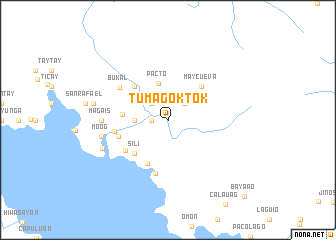
Tumagoktok (Camarines Sur, Philippines)Tumagoktok is a town in the Camarines Sur region of Philippines. An overview map of the region around Tumagoktok is displayed below.
regional and 3d topo map of Tumagoktok, Philippines ::
Tumagoktok airports ::
The nearest airport is MNL - Manila Ninoy Aquino Intl, located 187.1 km west of Tumagoktok.
Nearby towns ::
Komadogkadog (1.8km west) //
Buhaton (1.8km west) //
San Isidro (1.8km west) //
Tulatula (2.6km north east) //
Santa Rita (2.6km north west) //
Mansalaya (3.2km north west) //
Pinagdapian (3.6km west) //
Malobo (3.6km west) //
Pacto (4.2km north) //
Danawin (5.0km west) //
Sili (5.2km south west) //
Maycueva (5.2km north east) //
Kinalagñan (5.2km north west) //
Sinuknipan (5.3km south west) //
Madugo (5.7km south west) //
San Juan (5.7km west) //
Del Gallego (6.0km west) //
Catabangan (6.1km south) //
Bukal (6.4km north west) //
Magais (7.2km west) //
Cabagnajan (7.2km west) //
Moog (7.4km west) //
Sabang Kilbay (7.8km south west) //
Cabungalan (8.3km west) //
Bayaao (11.9km south east) //
[all distances 'as the bird flies' and approximate] 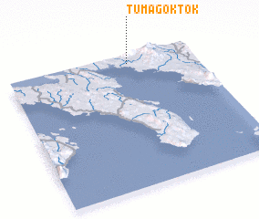 Places with similar names to Tumagoktok, Philippines :: Disclaimer :: Information on this page comes without warranty of any kind |
||
|
Where is Tumagoktok? Elevation and coordinates ::
Latitude (lat): 13°56'0"N Longitude (lon): 122°39'0"E
Elevation (approx.): 44m (map arrows pan, magnifying glasses zoom) |
||
|
Visiting Tumagoktok? Hotel/Accommodation ::
Book a hotel in Tumagoktok Travel Guide ::
Buy a travel guide for Philippines rental cars ::
car rental offers GPS waypoint ::
download a GPX waypoint (PoI) of Tumagoktok for your GPS receiver
|
||