|
search place name
|
||
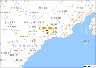
Tunghaan (Cebu, Philippines)Tunghaan is a town in the Cebu region of Philippines. An overview map of the region around Tunghaan is displayed below.
regional and 3d topo map of Tunghaan, Philippines ::
Tunghaan airports ::
The nearest airport is NOP - Masbate Mactan Cebu Intl, located 22.4 km east of Tunghaan.
Other airports nearby include BCD - Bacolod (103.1 km north west), DGT - Dumaguete (114.4 km south west), ILO - Iloilo (144.9 km west), TAC - Tacloban Daniel Z Romualdez (173.8 km north east), Nearby towns ::
Minglanilla (0.5km south) //
Tungkop (1.0km south east) //
Kalahoan (1.1km east) //
Inayagan (1.9km south) //
Kaduawan (1.9km north) //
Pakigne (1.8km east) //
Paquigne (1.8km east) //
Gindaruhan (1.8km east) //
Vito (2.1km north east) //
Guindarohan (2.3km north west) //
Linao (2.6km east) //
Tubod (2.6km north east) //
Tuyan (3.1km south west) //
Cogon (3.4km north west) //
Cayam (3.5km south west) //
Kuanos (3.6km north) //
Lawa-an (3.7km north east) //
Tawagan (4.0km north west) //
Colon (4.1km south west) //
Kantauan (4.1km north west) //
Cantabaco (4.1km north west) //
Lagtang (4.6km north east) //
Pook (4.8km east) //
Naga (5.1km south west) //
Patag (5.2km south west) //
Kantabaco (5.2km north west) //
Naupa (5.2km north west) //
Lutac (5.2km south west) //
Tagjaguimit (5.2km south west) //
[all distances 'as the bird flies' and approximate]  Places with similar names to Tunghaan, Philippines ::
Disclaimer :: Information on this page comes without warranty of any kind |
||
|
Where is Tunghaan? Elevation and coordinates ::
Latitude (lat): 10°15'0"N Longitude (lon): 123°47'0"E
Elevation (approx.): 58m (map arrows pan, magnifying glasses zoom) |
||
|
Visiting Tunghaan? Hotel/Accommodation ::
Book a hotel in Tunghaan Travel Guide ::
Buy a travel guide for Philippines rental cars ::
car rental offers GPS waypoint ::
download a GPX waypoint (PoI) of Tunghaan for your GPS receiver
|
||