|
search place name
|
||
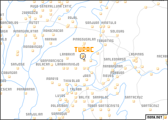
Turac (Nueva Ecija, Philippines)Turac is a town in the Nueva Ecija region of Philippines. An overview map of the region around Turac is displayed below.
regional and 3d topo map of Turac, Philippines ::
Turac airports ::
The nearest airport is MNL - Manila Ninoy Aquino Intl, located 95.8 km south of Turac.
Other airports nearby include BAG - Baguio (115.6 km north), Nearby towns ::
Putlod (0.0km north) //
San Pablo (1.4km east) //
Santa Cruz (1.9km south) //
Santo Tomas (2.0km south) //
Gubat na Munti (2.6km south west) //
Maliolio (3.0km north) //
San Anton (3.3km south east) //
Tambo (3.3km north east) //
Pinagsugalan (3.7km north) //
Lambakin (3.7km west) //
Cupang (4.0km south west) //
Lambakin Viejo (4.0km south west) //
Jaen (4.4km south) //
Lawang Kupang (4.8km south west) //
Langla (5.6km south) //
Alua (5.8km south) //
Sapang (5.8km south) //
Tabuating (5.7km north east) //
San Isidro (6.3km south) //
San Mariano (6.6km north east) //
Tikiw (6.6km south west) //
San Mariano (6.6km south west) //
Castellano (6.6km south east) //
Mambamgnan (6.6km east) //
San Leonardo (6.6km east) //
Nieves (6.8km south east) //
San Francisco (7.0km west) //
San Juan (7.6km north) //
La Fuente (7.6km north) //
[all distances 'as the bird flies' and approximate] 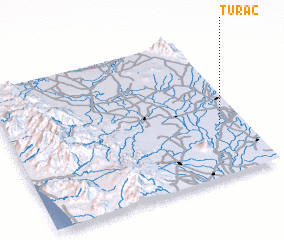 Places with similar names to Turac, Philippines ::
Disclaimer :: Information on this page comes without warranty of any kind |
||
|
Where is Turac? Elevation and coordinates ::
Latitude (lat): 15°22'0"N Longitude (lon): 120°54'0"E
Elevation (approx.): 22m (map arrows pan, magnifying glasses zoom) |
||
|
Visiting Turac? Hotel/Accommodation ::
Book a hotel in Turac Travel Guide ::
Buy a travel guide for Philippines rental cars ::
car rental offers GPS waypoint ::
download a GPX waypoint (PoI) of Turac for your GPS receiver
|
||