|
search place name
|
||
Upig (Bulacan, Philippines)Upig is a town in the Bulacan region of Philippines. An overview map of the region around Upig is displayed below.
regional and 3d topo map of Upig, Philippines ::

Upig airports ::
The nearest airport is MNL - Manila Ninoy Aquino Intl, located 57.3 km south of Upig.
Other airports nearby include BAG - Baguio (154.6 km north), Nearby towns ::
Pasong Bangkal (2.9km south east) //
Pasong Kallos (3.0km south) //
Salapuñgan (3.0km west) //
Pasong Insik (3.1km south) //
Licheria (3.1km south) //
Enchino (3.1km west) //
Palapala (4.0km north) //
Cruz Na Daan (4.5km west) //
Diliman (4.8km west) //
Maasim (5.3km south east) //
Umpucan (5.4km north) //
Palanas (5.4km north west) //
Bubulong Malaki (6.4km north) //
Magabe (6.2km north east) //
Cruz (6.3km west) //
Pinaod (6.4km north west) //
Maronquillo (6.6km south) //
Talaksan (6.7km south) //
Maguinao (6.5km west) //
San Roque (6.6km west) //
Marsim (6.7km north west) //
Bubulong Munti (7.1km north) //
Natimbobong (7.0km west) //
Matimbobong (7.0km north west) //
Pinakpinakan (7.2km south west) //
San Agustin (7.2km south west) //
Cafihan (7.1km south west) //
Adia (7.1km south west) //
Sampaloc (7.5km south west) //
[all distances 'as the bird flies' and approximate] 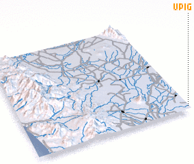 Places with similar names to Upig, Philippines ::
Disclaimer :: Information on this page comes without warranty of any kind |
||
|
Where is Upig? Elevation and coordinates ::
Latitude (lat): 15°1'34"N Longitude (lon): 120°59'37"E
Elevation (approx.): 28m (map arrows pan, magnifying glasses zoom) |
||
|
Visiting Upig? Hotel/Accommodation ::
Book a hotel in Upig Travel Guide ::
Buy a travel guide for Philippines rental cars ::
car rental offers GPS waypoint ::
download a GPX waypoint (PoI) of Upig for your GPS receiver
|
||