|
search place name
|
||
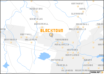
Blacktown (New South Wales, Australia)Blacktown is a town in the New South Wales region of Australia. An overview map of the region around Blacktown is displayed below.
regional and 3d topo map of Blacktown, Australia ::
Blacktown airports ::
The nearest airport is BWU - Sydney Bankstown, located 18.7 km south of Blacktown.
Other airports nearby include RCM - Richmond (22.3 km north west), SYD - Sydney Intl (31.3 km south east), CDU - Camden (37.0 km south west), CBR - Canberra (232.7 km south west), Nearby towns ::
Seven Hills (2.4km south east) //
Toongabbie West (2.4km south east) //
Toongabbie (3.6km south east) //
Pendle Hills (4.8km south east) //
Quakers Hill (4.8km north west) //
Doonside (4.6km west) //
Northmead (6.4km east) //
Wallgrove (6.4km west) //
Wentworthville (7.2km south east) //
Schofields (7.2km north west) //
Holroyd (8.0km south east) //
Westmead (8.3km south east) //
Merrylands (9.6km south east) //
[all distances 'as the bird flies' and approximate]  Places with similar names to Blacktown, Australia ::
// Blackton (US)
// Bleckden (DE)
// Bullocktown (US)
// Blockton (US)
// Balakhton (RU)
// Blocktown (US)
// Blacktown (US)
// Balakottunna (LK)
// Bulukatoni (UG)
// Blagdon (GB)
Disclaimer :: Information on this page comes without warranty of any kind |
||
|
Where is Blacktown? Elevation and coordinates ::
Latitude (lat): 33°46'0"S Longitude (lon): 150°55'0"E
Elevation (approx.): 61m (map arrows pan, magnifying glasses zoom) |
||
|
Visiting Blacktown? Hotel/Accommodation ::
Book a hotel in Blacktown Travel Guide ::
Buy a travel guide for Australia rental cars ::
car rental offers GPS waypoint ::
download a GPX waypoint (PoI) of Blacktown for your GPS receiver
|
||