|
search place name
|
||
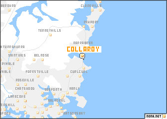
Collaroy (New South Wales, Australia)Collaroy is a town in the New South Wales region of Australia. An overview map of the region around Collaroy is displayed below.
regional and 3d topo map of Collaroy, Australia ::
Collaroy airports ::
The nearest airport is SYD - Sydney Intl, located 26.2 km south west of Collaroy.
Other airports nearby include BWU - Sydney Bankstown (35.8 km south west), RCM - Richmond (50.4 km west), CDU - Camden (66.1 km south west), Nearby towns ::
Deewhy (1.9km south) //
Narrabeen (2.8km north) //
Curl Curl (3.8km south) //
Brookvale (4.8km south west) //
Bay View (7.4km north) //
Mona Vale (7.4km north) //
Newport (7.6km north) //
Manly (7.6km south) //
Balgowlah (8.0km south west) //
Balgowlah Heights (8.9km south west) //
Terrey Hills (8.3km north west) //
Clontarf (9.4km south west) //
Seaforth (9.5km south west) //
North Bridge (11.2km south west) //
[all distances 'as the bird flies' and approximate] 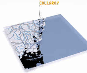 Places with similar names to Collaroy, Australia ::
Disclaimer :: Information on this page comes without warranty of any kind |
||
|
Where is Collaroy? Elevation and coordinates ::
Latitude (lat): 33°44'0"S Longitude (lon): 151°18'0"E
Elevation (approx.): 21m (map arrows pan, magnifying glasses zoom) |
||
|
Visiting Collaroy? Hotel/Accommodation ::
Book a hotel in Collaroy Travel Guide ::
Buy a travel guide for Australia rental cars ::
car rental offers GPS waypoint ::
download a GPX waypoint (PoI) of Collaroy for your GPS receiver
|
||