|
search place name
|
||
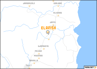
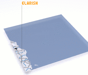
El Arish (Queensland, Australia)El Arish is a town in the Queensland region of Australia. An overview map of the region around El Arish is displayed below.
regional and 3d topo map of El Arish, Australia ::
El Arish airports ::
The nearest airport is CNS - Cairns Intl, located 106.3 km north of El Arish.
Other airports nearby include TSV - Townsville (178.3 km south east), Nearby towns ::
 Places with similar names to El Arish, Australia ::
// El Urecho (MX)
// El Arch (MR)
// El Rusio (HN)
// El Arich (MA)
// El Ahroucha (MA)
// El Arouach (MA)
// Ellrich (DE)
// El Araïch (MA)
// El Aricha (DZ)
// El Arrouch (DZ)
Disclaimer :: Information on this page comes without warranty of any kind |
||
|
Where is El Arish? Elevation and coordinates ::
Latitude (lat): 17°49'0"S Longitude (lon): 146°0'0"E
Elevation (approx.): 26m (map arrows pan, magnifying glasses zoom) |
||
|
Visiting El Arish? Hotel/Accommodation ::
Book a hotel in El Arish Travel Guide ::
Buy a travel guide for Australia rental cars ::
car rental offers GPS waypoint ::
download a GPX waypoint (PoI) of El Arish for your GPS receiver
|
||