|
search place name
|
||
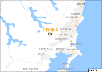
Kembla (New South Wales, Australia)Kembla is a town in the New South Wales region of Australia. An overview map of the region around Kembla is displayed below.
regional and 3d topo map of Kembla, Australia ::
Kembla airports ::
The nearest airport is CDU - Camden, located 45.2 km north of Kembla.
Other airports nearby include BWU - Sydney Bankstown (58.6 km north), SYD - Sydney Intl (63.4 km north east), RCM - Richmond (92.4 km north), CBR - Canberra (177.1 km south west), Nearby towns ::
Unanderra (3.6km south east) //
Mount Keira (3.8km north east) //
Figtree (3.8km east) //
Keiraville (4.9km east) //
Brownsville (5.8km south) //
Mangerton (5.1km east) //
Mount Saint Thomas (5.2km east) //
McArthur Heights (5.4km east) //
Berkeley (6.3km south east) //
Mount Drummond (5.7km east) //
Wollongong (6.1km east) //
Mount Ousley (6.5km north east) //
Coniston (6.4km east) //
Gwynneville (6.8km east) //
Cringila (7.1km south east) //
Dapto (8.0km south) //
Lake Heights (8.0km south east) //
Fern Hill (8.5km north east) //
Fairy Meadow (8.3km north east) //
Warrawong (8.7km south east) //
Tarrawanna (8.9km north east) //
Kemblawarra (9.6km south east) //
[all distances 'as the bird flies' and approximate] 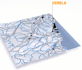 Places with similar names to Kembla, Australia ::
Disclaimer :: Information on this page comes without warranty of any kind |
||
|
Where is Kembla? Elevation and coordinates ::
Latitude (lat): 34°26'0"S Longitude (lon): 150°49'0"E
Elevation (approx.): 136m (map arrows pan, magnifying glasses zoom) |
||
|
Visiting Kembla? Hotel/Accommodation ::
Book a hotel in Kembla Travel Guide ::
Buy a travel guide for Australia rental cars ::
car rental offers GPS waypoint ::
download a GPX waypoint (PoI) of Kembla for your GPS receiver
|
||