|
search place name
|
||
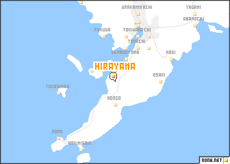
Hirayama (Nagasaki, Japan)Hirayama is a town in the Nagasaki region of Japan. An overview map of the region around Hirayama is displayed below.
regional and 3d topo map of Hirayama, Japan ::
Hirayama airports ::
The nearest airport is NGS - Nagasaki, located 28.8 km north of Hirayama.
Other airports nearby include FUJ - Fukue (93.9 km west), KMJ - Kumamoto (97.6 km east), FUK - Fukuoka (117.1 km north east), IKI - Iki (120.1 km north), Nearby towns ::
Keinokubimachi (1.9km north) //
Sueishimachi (1.9km north) //
Fukahori (2.4km north west) //
Ariumi (2.4km north west) //
Nagahama (2.4km north west) //
Tanoura (2.4km north west) //
Hongō (3.7km south) //
Onouechō (3.6km north west) //
Sembonyama (4.0km north east) //
Kibachi (5.8km north) //
Megami (5.8km north) //
Tomachi (6.4km north east) //
Kamigō (6.4km north east) //
Kokubuchō (6.4km north east) //
Kosugemachi (6.4km north east) //
Minoo (6.4km north east) //
Ōsaki (6.2km east) //
Fukuda (7.6km north) //
Akunouramachi (7.6km north) //
Nishidomarimachi (7.6km north) //
Ōtao (7.6km north) //
Takami (7.3km north east) //
Matsugaechō (8.0km north east) //
Higashi-kotohiramachi (8.0km north east) //
Nishi-kotohiramachi (8.0km north east) //
Tokiwamachi (8.0km north east) //
Naminohiramachi (8.0km north east) //
Iriemachi (8.8km north east) //
Dejimamachi (8.8km north east) //
[all distances 'as the bird flies' and approximate]  Places with similar names to Hirayama, Japan ::
// Hirayama (JP)
Disclaimer :: Information on this page comes without warranty of any kind |
||
|
Where is Hirayama? Elevation and coordinates ::
Latitude (lat): 32°40'0"N Longitude (lon): 129°50'0"E
Elevation (approx.): 53m (map arrows pan, magnifying glasses zoom) |
||
|
Visiting Hirayama? Hotel/Accommodation ::
Book a hotel in Hirayama Travel Guide ::
Buy a travel guide for Japan rental cars ::
car rental offers GPS waypoint ::
download a GPX waypoint (PoI) of Hirayama for your GPS receiver
|
||