|
search place name
|
||
Nishihara (Okinawa, Japan)Nishihara is a town in the Okinawa region of Japan. An overview map of the region around Nishihara is displayed below.
regional and 3d topo map of Nishihara, Japan ::

Nishihara airports ::
The nearest airport is OKA - Naha, located 11.2 km south west of Nishihara.
Other airports nearby include DNA - Kadena Ab (11.9 km north), UEO - Kumejima (103.2 km west), RNJ - Yoron (109.8 km north east), TKN - Tokunoshima (209.0 km north east), Nearby towns ::
Kakazu (0.7km west) //
Ganiku (1.0km east) //
Ginowan (1.0km east) //
Onaga (1.5km south) //
Maeda (1.7km south) //
Makiminato (1.8km north) //
Oyama (1.8km north) //
Uchitomari (1.8km north) //
Ōjana (1.8km north) //
Tanabaru (1.8km south east) //
Kōchi (2.0km south) //
Ahacha (2.0km south west) //
Nakama (2.3km west) //
Yafusu (2.3km west) //
Minatogawa (2.9km north west) //
Minamiuebaru (3.1km east) //
Kamiyama (3.2km north east) //
Ishiminechō (3.4km south west) //
Kohazu (3.6km south) //
Urazoe (3.3km west) //
Isa (3.7km north) //
Ijū (3.5km south east) //
Takushi (3.6km south west) //
Amuro (3.9km south) //
Kowan (3.6km west) //
Yonagusuku (4.0km south east) //
Shuri (4.1km south west) //
Gusukuma (4.0km west) //
Ōna (4.5km south west) //
[all distances 'as the bird flies' and approximate] 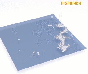 Places with similar names to Nishihara, Japan ::
Disclaimer :: Information on this page comes without warranty of any kind |
||
|
Where is Nishihara? Elevation and coordinates ::
Latitude (lat): 26°15'5"N Longitude (lon): 127°44'23"E
Elevation (approx.): 79m (map arrows pan, magnifying glasses zoom) |
||
|
Visiting Nishihara? Hotel/Accommodation ::
Book a hotel in Nishihara Travel Guide ::
Buy a travel guide for Japan rental cars ::
car rental offers GPS waypoint ::
download a GPX waypoint (PoI) of Nishihara for your GPS receiver
|
||