|
search place name
|
||
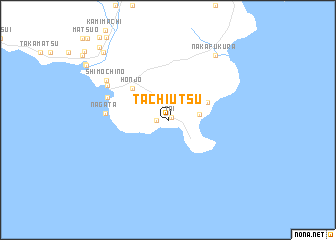
Tachiutsu (Miyazaki, Japan)Tachiutsu is a town in the Miyazaki region of Japan. An overview map of the region around Tachiutsu is displayed below.
regional and 3d topo map of Tachiutsu, Japan ::
Tachiutsu airports ::
The nearest airport is KMI - Miyazaki, located 56.3 km north of Tachiutsu.
Other airports nearby include KOJ - Kagoshima (72.2 km north west), TNE - New Tanegashima (91.4 km south), KUM - Yakushima (126.7 km south west), KMJ - Kumamoto (166.5 km north), Nearby towns ::
Toi (0.4km north east) //
Kuroi (1.1km west) //
Miyanoura (3.0km east) //
Koigaura (4.2km north east) //
Honjō (4.9km north west) //
Nagata (6.1km west) //
Sakida (6.3km north west) //
Minato (7.0km north west) //
Shimochino (7.4km north west) //
Ishinami (8.5km north east) //
Nakafukura (8.5km north east) //
Maeda (9.7km north west) //
Kushima (10.5km north west) //
[all distances 'as the bird flies' and approximate] 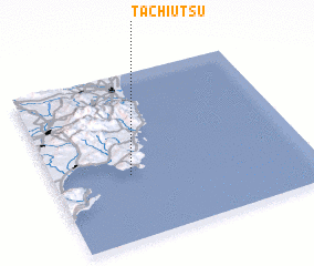 Places with similar names to Tachiutsu, Japan ::
// Ta Chaitzu (MM)
// Teuchatz (DE)
// Tyshitsa (UA)
// Tshitazu (CD)
// Ti-shui-tzu (TW)
// Dechtice (SK)
// Tuchotice (CZ)
// Tao-tiao-tzu (TW)
// Ti-shui-tzu (TW)
Disclaimer :: Information on this page comes without warranty of any kind |
||
|
Where is Tachiutsu? Elevation and coordinates ::
Latitude (lat): 31°23'6"N Longitude (lon): 131°18'9"E
Elevation (approx.): -32768m (map arrows pan, magnifying glasses zoom) |
||
|
Visiting Tachiutsu? Hotel/Accommodation ::
Book a hotel in Tachiutsu Travel Guide ::
Buy a travel guide for Japan rental cars ::
car rental offers GPS waypoint ::
download a GPX waypoint (PoI) of Tachiutsu for your GPS receiver
|
||